LiODOM: Adaptive Local Mapping for Robust LiDAR-Only Odometry
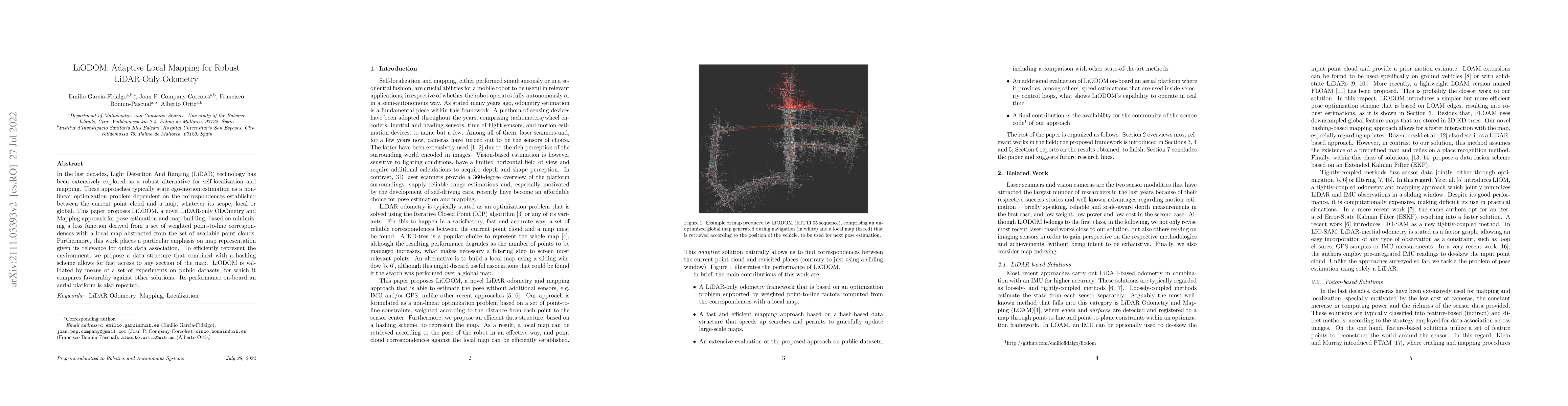
Publication
Metrics
AI Quick Summary
LiODOM presents a LiDAR-only odometry and mapping method for pose estimation and map-building using adaptive local map representation and weighted point-to-line correspondences. The approach is validated on public datasets and demonstrates robust performance on aerial platforms.
Paper Preview
Abstract
In the last decades, Light Detection And Ranging (LiDAR) technology has been extensively explored as a robust alternative for self-localization and mapping. These approaches typically state ego-motion estimation as a non-linear optimization problem dependent on the correspondences established between the current point cloud and a map, whatever its scope, local or global. This paper proposes LiODOM, a novel LiDAR-only ODOmetry and Mapping approach for pose estimation and map-building, based on minimizing a loss function derived from a set of weighted point-to-line correspondences with a local map abstracted from the set of available point clouds. Furthermore, this work places a particular emphasis on map representation given its relevance for quick data association. To efficiently represent the environment, we propose a data structure that combined with a hashing scheme allows for fast access to any section of the map. LiODOM is validated by means of a set of experiments on public datasets, for which it compares favourably against other solutions. Its performance on-board an aerial platform is also reported.
AI Key Findings
Get AI-generated insights about this paper's methodology, results, significance, and more — seven facets brought into focus.
Impact
Paper Details
Authors
PDF Preview
Key Terms
Citation Network
Current paper (gray), citations (green), references (blue)
Display is limited for performance on very large graphs.
Discussion 0