Authors
Summary
The growth in availability of large-scale GPS mobility data from mobile devices has the potential to aid traditional travel demand models (TDMs) such as the four-step planning model, but those processing methods are not commonly used in practice. In this study, we show the application of trip generation and trip distribution modeling using GPS data from smartphones in the state of Indiana. This involves extracting trip segments from the data and inferring the phone users' home locations, adjusting for data representativeness, and using a data-driven travel time-based cost function for the trip distribution model. The trip generation and interchange patterns in the state are modeled for 2025, 2035, and 2045. Employment sectors like industry and retail are observed to influence trip making behavior more than other sectors. The travel growth is predicted to be mostly concentrated in the suburban regions, with a small decline in the urban cores. Further, although the majority of the growth in trip flows over the years is expected to come from the corridors between the major urban centers of the state, relative interzonal trip flow growth will likely be uniformly spread throughout the state. We also validate our results with the forecasts of two travel demand models, finding a difference of 5-15% in overall trip counts. Our GPS data-based demand model will contribute towards augmenting the conventional statewide travel demand model developed by the state and regional planning agencies.
AI Key Findings
Get AI-generated insights about this paper's methodology, results, and significance.
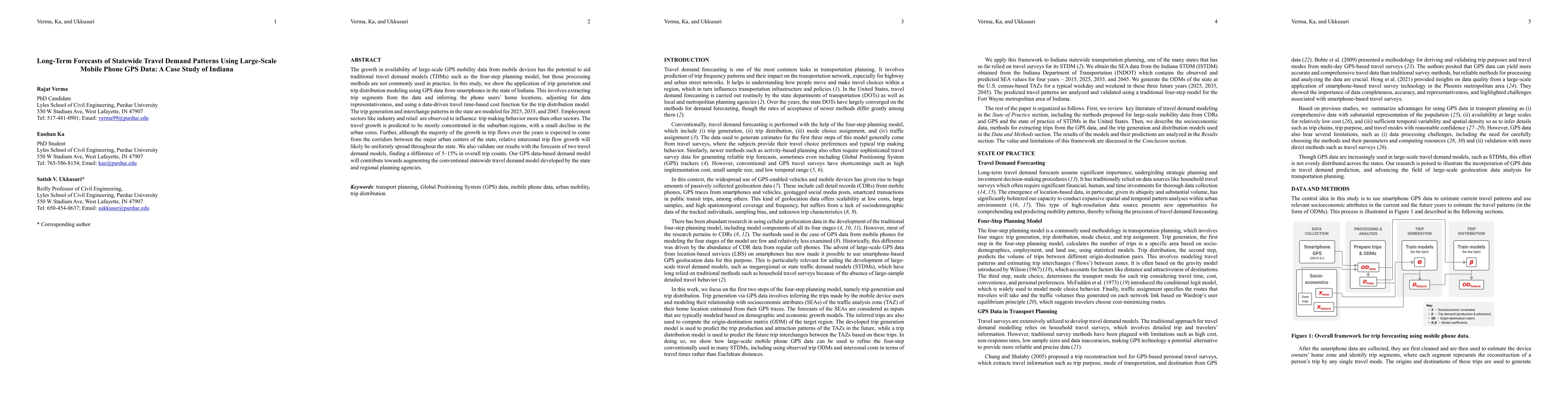
Paper Details
PDF Preview
Key Terms
Citation Network
Current paper (gray), citations (green), references (blue)
Display is limited for performance on very large graphs.
Similar Papers
Found 4 papersFeel Old Yet? Updating Mode of Transportation Distributions from Travel Surveys using Data Fusion with Mobile Phone Data
Eduardo Graells-Garrido, Francisco Rowe, Daniela Opitz et al.
No citations found for this paper.
Comments (0)