01
MethodologyHow they did it
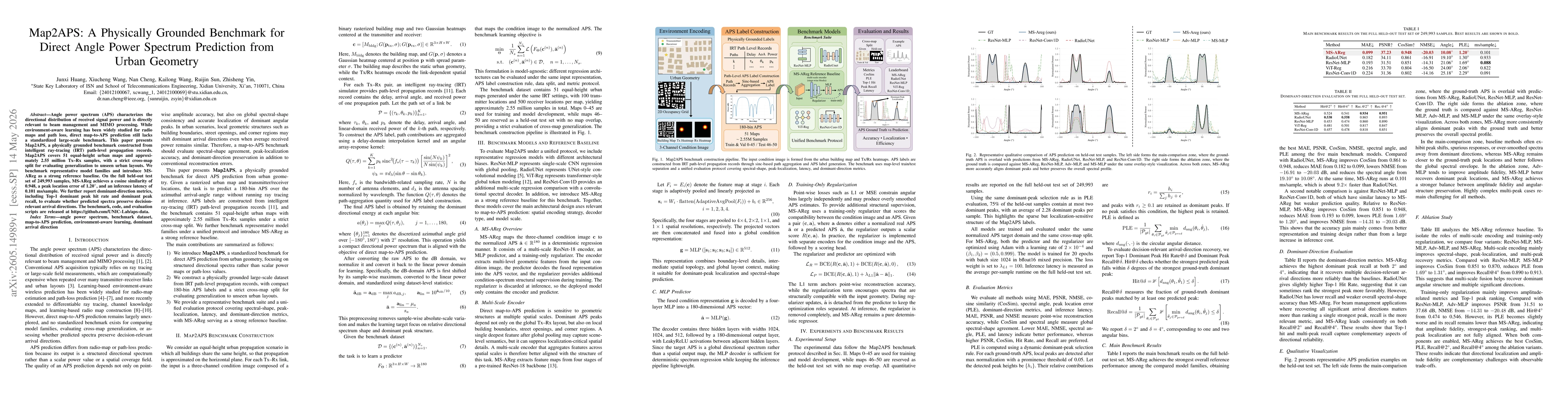
Map2APS constructs a standardized input-output framework where each Tx–Rx link is represented by a three-channel condition image (building map and two Gaussian heatmaps) and the target APS is a 180-bin directional spectrum derived from intelligent ray-tracing path-level data. It uses a strict cross-map split across 51 urban maps, converts APS labels to a normalized dB-linear domain, and evaluates model predictions with a unified protocol across spectral-shape, peak localization, and dominant-direction metrics, plus latency.
Discussion 0