Authors
Summary
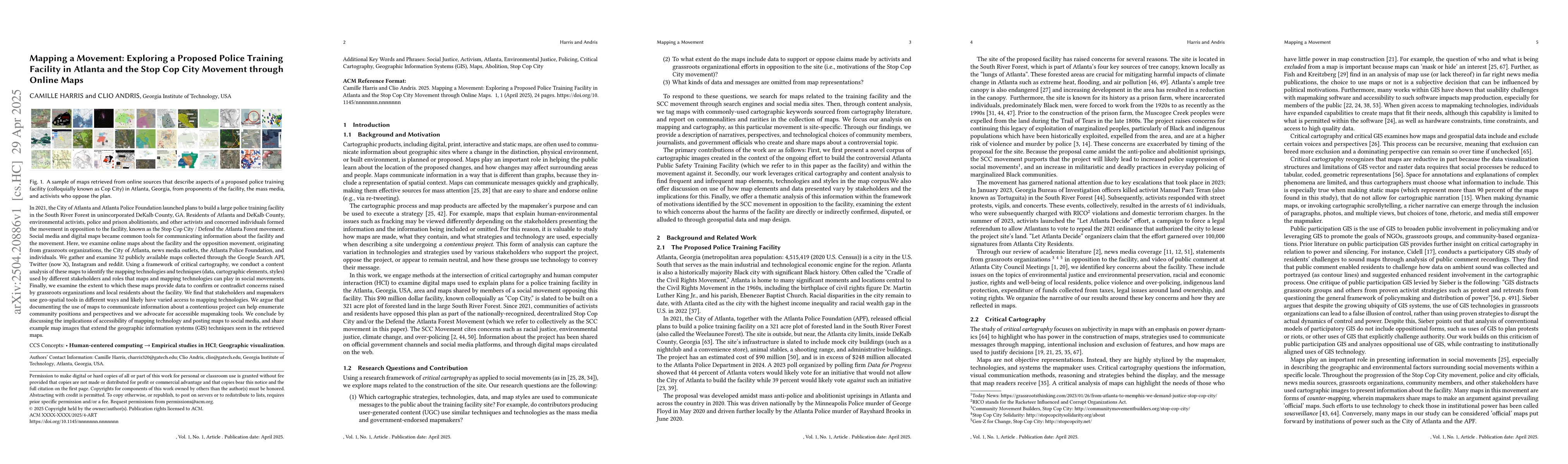
In 2021, the City of Atlanta and Atlanta Police Foundation launched plans to build a large police training facility in the South River Forest in unincorporated DeKalb County, GA. Residents of Atlanta and DeKalb County, environmental activists, police and prison abolitionists, and other activists and concerned individuals formed the movement in opposition to the facility, known as the Stop Cop City / Defend the Atlanta Forest movement. Social media and digital maps became common tools for communicating information about the facility and the movement. Here, we examine online maps about the facility and the opposition movement, originating from grassroots organizations, the City of Atlanta, news media outlets, the Atlanta Police Foundation, and individuals. We gather and examine 32 publicly available maps collected through the Google Search API, Twitter (now X), Instagram and reddit. Using a framework of critical cartography, we conduct a content analysis of these maps to identify the mapping technologies and techniques (data, cartographic elements, styles) used by different stakeholders and roles that maps and mapping technologies can play in social movements. We examine the extent to which these maps provide data to confirm or contradict concerns raised by grassroots organizations and local residents about the facility. We find that stakeholders and mapmakers use geospatial tools in different ways and likely have varied access to mapping technologies. We argue that documenting the use of maps to communicate information about a contentious project can help enumerate community positions and perspectives, and we advocate for accessible mapmaking tools. We conclude by discussing the implications of accessibility of mapping technology and posting maps to social media, and share example map images that extend the geographic information systems (GIS) techniques seen in the retrieved maps.
AI Key Findings
Generated Jun 08, 2025
Methodology
The study examines 32 publicly available maps from various sources like grassroots organizations, City of Atlanta, news media, Atlanta Police Foundation, and individuals, using a critical cartography framework for content analysis.
Key Results
- Stakeholders use geospatial tools differently, indicating varied access to mapping technologies.
- Maps play a significant role in communicating information about the contentious police training facility project.
- The analysis reveals mapping techniques and technologies employed by diverse stakeholders.
Significance
Documenting map usage in social movements can help enumerate community positions and perspectives, advocating for accessible mapmaking tools.
Technical Contribution
Provides a critical cartography framework for analyzing maps in social movements, highlighting the role of geospatial tools in contentious projects.
Novelty
This research distinguishes itself by focusing on the Stop Cop City movement and employing a comprehensive analysis of diverse map sources, contributing to understanding the role of mapping in social activism.
Limitations
- The study does not explore in-depth the technical aspects of the mapping technologies used.
- Limited to publicly available maps, potentially missing private or restricted data sources.
Future Work
- Investigate the technical capabilities and limitations of mapping tools used by various stakeholders.
- Explore the impact of mapping technologies on shaping public discourse and policy decisions.
Paper Details
PDF Preview
Citation Network
Current paper (gray), citations (green), references (blue)
Display is limited for performance on very large graphs.
Similar Papers
Found 4 papersMultilingualism, Transnationality, and K-pop in the Online #StopAsianHate Movement
Brendan O'Connor, Ethan Zuckerman, Tessa Masis et al.
Exploring Descriptions of Movement Through Geovisual Analytics
Prasenjit Mitra, Alan M. MacEachren, Scott Pezanowski
No citations found for this paper.
Comments (0)