Publication
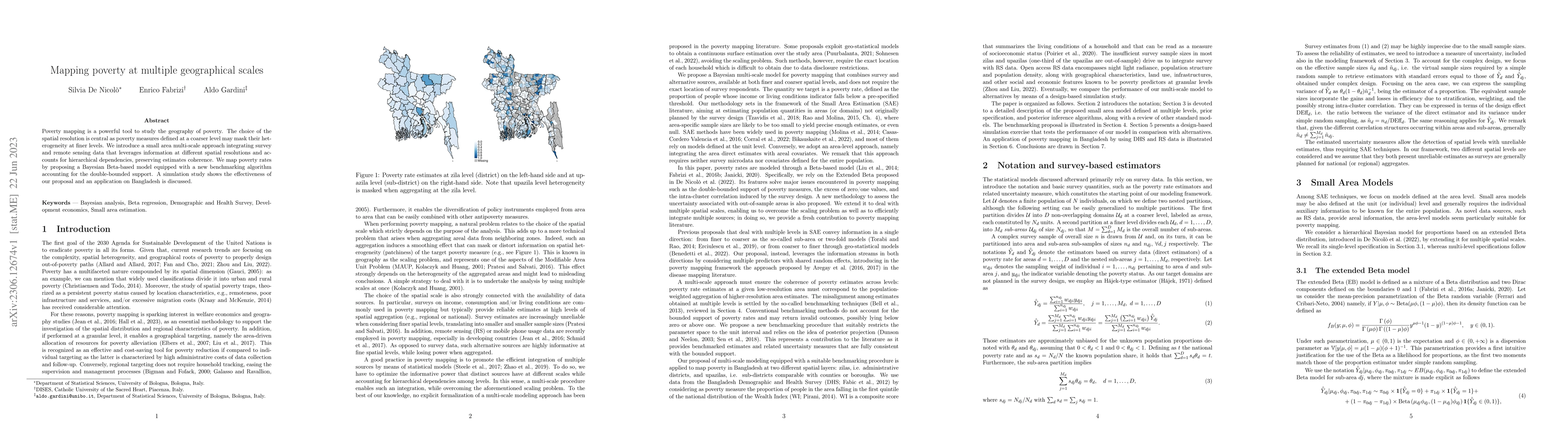
Metrics
AI Quick Summary
This paper introduces a multi-scale approach for poverty mapping that integrates survey and remote sensing data, employing a Bayesian Beta-based model with a new benchmarking algorithm to account for hierarchical dependencies and double-bounded support. The method is demonstrated through a simulation study and an application in Bangladesh.
Paper Preview
Abstract
Poverty mapping is a powerful tool to study the geography of poverty. The choice of the spatial resolution is central as poverty measures defined at a coarser level may mask their heterogeneity at finer levels. We introduce a small area multi-scale approach integrating survey and remote sensing data that leverages information at different spatial resolutions and accounts for hierarchical dependencies, preserving estimates coherence. We map poverty rates by proposing a Bayesian Beta-based model equipped with a new benchmarking algorithm that accounts for the double-bounded support. A simulation study shows the effectiveness of our proposal and an application on Bangladesh is discussed.
AI Key Findings
Get AI-generated insights about this paper's methodology, results, significance, and more — seven facets brought into focus.
Impact
Paper Details
Authors
PDF Preview
Key Terms
Citation Network
Current paper (gray), citations (green), references (blue)
Display is limited for performance on very large graphs.
Discussion 0