Mapping the Periphery and Variability of the Magellanic Clouds
Publication
Metrics
AI Quick Summary
This research proposes a comprehensive survey using modified observational techniques to create a detailed 3-D map of the Magellanic Clouds and to catalog their transient and variable populations. The survey includes a wide-ranging, deep-drilling style approach to cover the Magellanic System's periphery and variability.
Paper Preview
Abstract
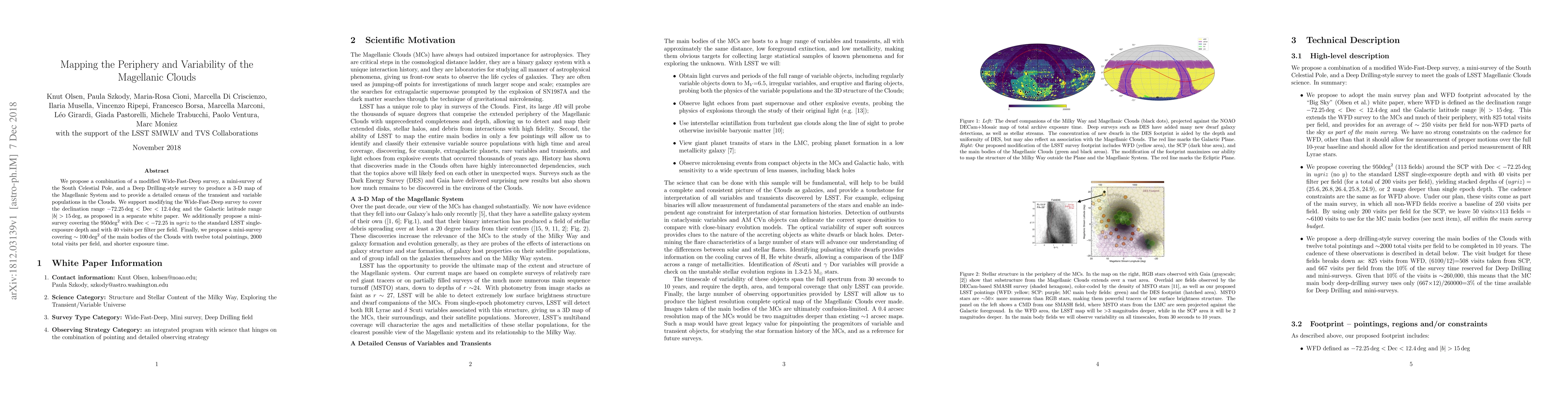
We propose a combination of a modified Wide-Fast-Deep survey, a mini-survey of the South Celestial Pole, and a Deep Drilling-style survey to produce a 3-D map of the Magellanic System and to provide a detailed census of the transient and variable populations in the Clouds. We support modifying the Wide-Fast-Deep survey to cover the declination range $-72.25\deg<{\rm Dec}<12.4\deg$ and the Galactic latitude range $|b|>15\deg$, as proposed in a separate white paper. We additionally propose a mini-survey covering the 950$\deg^2$ with ${\rm Dec} < -72.25$ in $ugriz$ to the standard LSST single-exposure depth and with 40 visits per filter per field. Finally, we propose a mini-survey covering $\sim100 \deg^2$ of the main bodies of the Clouds with twelve total pointings, 2000 total visits per field, and shorter exposure time.
AI Key Findings
Get AI-generated insights about this paper's methodology, results, significance, and more — seven facets brought into focus.
Impact
Paper Details
PDF Preview
Key Terms
Citation Network
Current paper (gray), citations (green), references (blue)
Display is limited for performance on very large graphs.
Discussion 0