Publication
Metrics
Paper Preview
Abstract
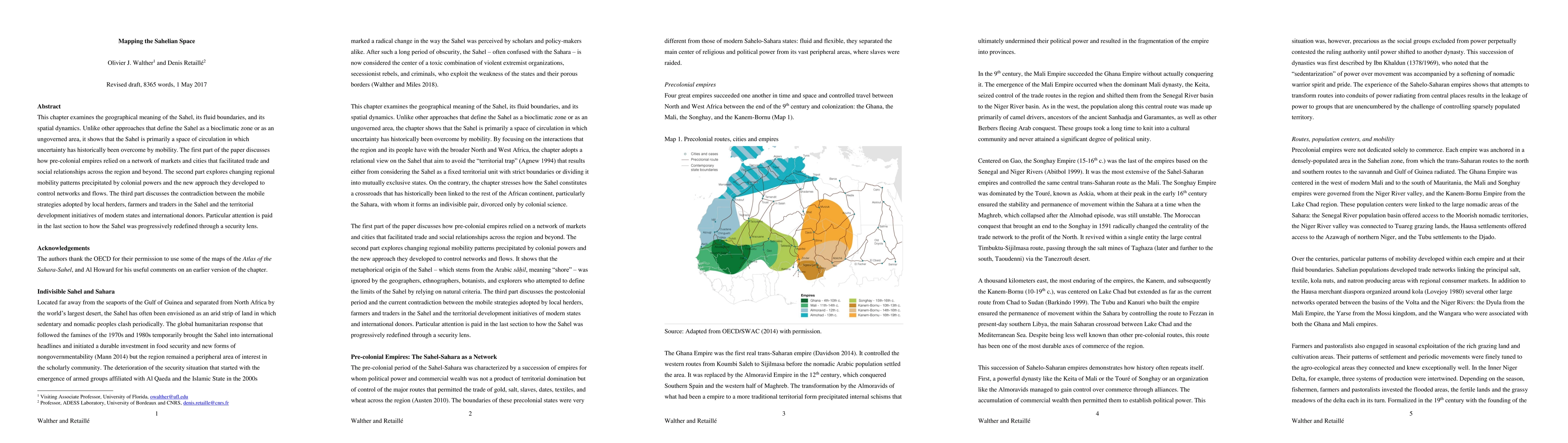
This chapter examines the geographical meaning of the Sahel, its fluid boundaries, and its spatial dynamics. Unlike other approaches that define the Sahel as a bioclimatic zone or as an ungoverned area, it shows that the Sahel is primarily a space of circulation in which uncertainty has historically been overcome by mobility. The first part of the paper discusses how pre-colonial empires relied on a network of markets and cities that facilitated trade and social relationships across the region and beyond. The second part explores changing regional mobility patterns precipitated by colonial powers and the new approach they developed to control networks and flows. The third part discusses the contradiction between the mobile strategies adopted by local herders, farmers and traders in the Sahel and the territorial development initiatives of modern states and international donors. Particular attention is paid in the last section to how the Sahel was progressively redefined through a security lens.
AI Key Findings
Get AI-generated insights about this paper's methodology, results, significance, and more — seven facets brought into focus.
Impact
Paper Details
PDF Preview
Key Terms
Citation Network
Current paper (gray), citations (green), references (blue)
Display is limited for performance on very large graphs.
Discussion 0