ArxivLens

Publication

Published: May 28, 2025
Categories: cs.HC, cs.AI, cs.CL

Metrics

Source: ArXiv

AI Quick Summary

MapStory is an AI-powered tool that generates editable map animations from natural language text, enabling users to create map-centric stories with ease and speed.

Quick Answers

What is "MapStory: LLM-Powered Text-Driven Map Animation Prototyping with Human-in-the-Loop Editing" about?

MapStory is an AI-powered tool that generates editable map animations from natural language text, enabling users to create map-centric stories with ease and speed.

What methodology did the authors use?

The research methodology involved formative interviews with professional animators, analysis of 200 existing map animation videos, expert interviews (N=5), and a usability study (N=12). More in Methodology →

What are the key results?

MapStory enables users to create map animations with ease. — The system facilitates faster iteration and encourages creative exploration. More in Key Results →

Why is this work significant?

This research is important as it introduces an LLM-powered tool that simplifies map animation creation, making it more accessible to users without extensive animation expertise, and potentially impacting fields like urban planning, geography education, and data visualization. More in Significance →

What are the main limitations?

The paper does not explicitly discuss limitations. — Evaluation is limited to 5 expert interviews and 12 usability study participants. More in Limitations →

Paper Preview

Abstract

We introduce MapStory, an LLM-powered animation authoring tool that generates editable map animation sequences directly from natural language text. Given a 
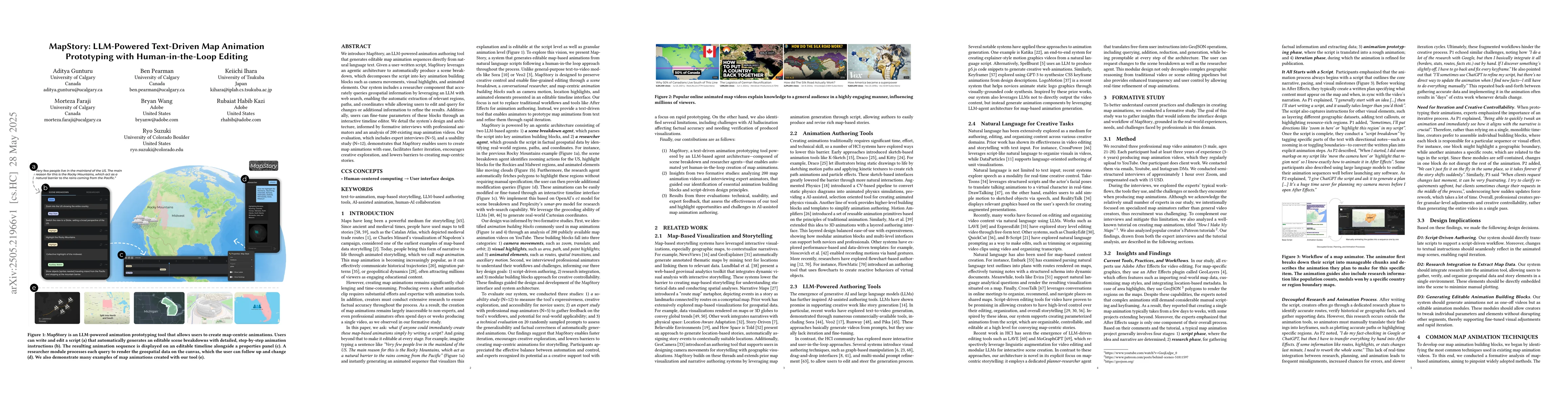
user-written script, MapStory leverages an agentic architecture to automatically produce a scene breakdown, which decomposes the script into key animation building blocks such as camera movements, visual highlights, and animated elements. Our system includes a researcher component that accurately queries geospatial information by leveraging an LLM with web search, enabling the automatic extraction of relevant regions, paths, and coordinates while allowing users to edit and query for changes or additional information to refine the results. Additionally, users can fine-tune parameters of these blocks through an interactive timeline editor. We detail the system's design and architecture, informed by formative interviews with professional animators and an analysis of 200 existing map animation videos. Our evaluation, which includes expert interviews (N=5) and a usability study (N=12), demonstrates that MapStory enables users to create map animations with ease, facilitates faster iteration, encourages creative exploration, and lowers barriers to creating map-centric stories.

Key Findings, in focus

Seven facets of this paper, analysed and brought into focus by AI.

AI-generated · verify against source Generated Jun 07, 2025
In focus · one-line synthesis

This research is important as it introduces an LLM-powered tool that simplifies map animation creation, making it more accessible to users without extensive animation expertise, and potentially impacting fields like urban planning, geography education, and data visualization.

01
MethodologyHow they did it

The research methodology involved formative interviews with professional animators, analysis of 200 existing map animation videos, expert interviews (N=5), and a usability study (N=12).

02
ResultsWhat they found
  • MapStory enables users to create map animations with ease.
  • The system facilitates faster iteration and encourages creative exploration.
  • MapStory lowers barriers to creating map-centric stories.
  • An agentic architecture automatically produces scene breakdowns from user scripts.
  • A researcher component accurately queries geospatial information using an LLM and web search.
03
SignificanceWhy it matters

This research is important as it introduces an LLM-powered tool that simplifies map animation creation, making it more accessible to users without extensive animation expertise, and potentially impacting fields like urban planning, geography education, and data visualization.

04
Technical ContributionsWhat's new technically

The main technical contribution is the development of an agentic architecture that leverages large language models (LLMs) for text-to-animation mapping, combined with a geospatial information querying system.

05
NoveltyWhat sets it apart

MapStory stands out by combining large language models with map animation prototyping, incorporating human-in-the-loop editing, and automating geospatial information extraction from natural language scripts.

06
LimitationsWhat to be cautious about
  • The paper does not explicitly discuss limitations.
  • Evaluation is limited to 5 expert interviews and 12 usability study participants.
07
Future WorkWhere it goes next
  • Explore integration with more advanced geospatial data sources.
  • Investigate scalability for handling larger and more complex scripts.

Impact

65
References

Paper Details

Paper ID: 2505.21966
Comments: 16 pages and 15 figures
Categories:
cs.HC cs.AI cs.CL cs.MM H.5.2 H.5.1

How to Cite This Paper

Reference manager: RIS EndNote

Citation Network

Current paper (gray), citations (green), references (blue)

Display is limited for performance on very large graphs.

Current Paper
Citations
References
Click to view

Related Papers

4 found


Discussion 0

This website uses cookies to ensure you get the best experience. Learn more