Market Areas in General Equilibrium
Publication
Metrics
AI Quick Summary
This paper develops a spatial model of market areas in general equilibrium, demonstrating the formation of a tessellation of exclusive market areas. It characterizes the impact of economic shocks on market borders and inhabited cities, employing computational geometry and shape optimization.
Paper Preview
Abstract
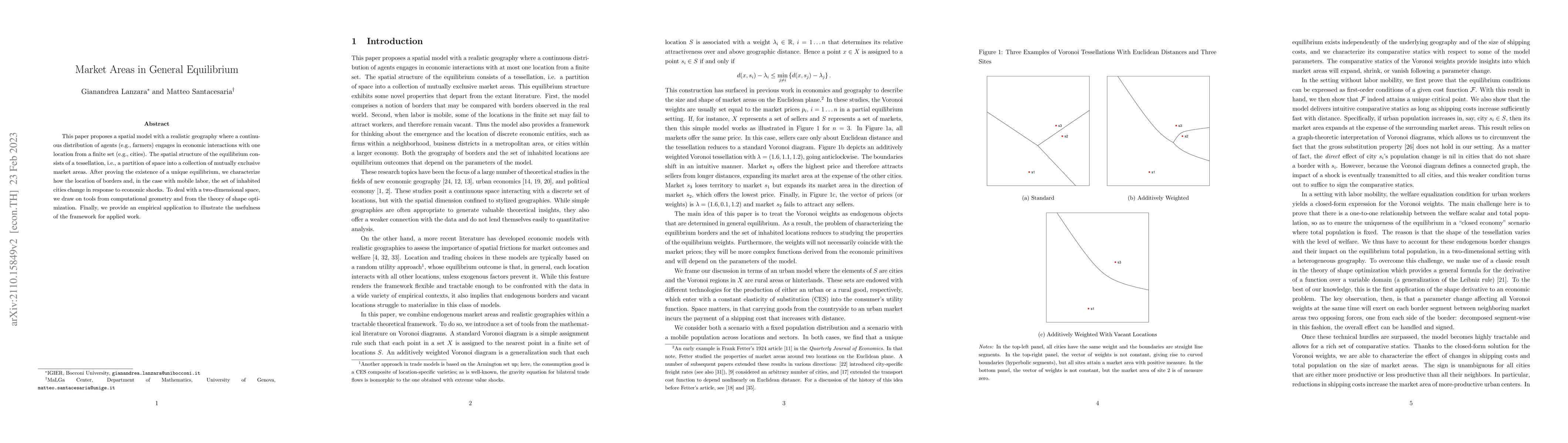
This paper proposes a spatial model with a realistic geography where a continuous distribution of agents (e.g., farmers) engages in economic interactions with one location from a finite set (e.g., cities). The spatial structure of the equilibrium consists of a tessellation, i.e., a partition of space into a collection of mutually exclusive market areas. After proving the existence of a unique equilibrium, we characterize how the location of borders and, in the case with mobile labor, the set of inhabited cities change in response to economic shocks. To deal with a two-dimensional space, we draw on tools from computational geometry and from the theory of shape optimization. Finally, we provide an empirical application to illustrate the usefulness of the framework for applied work.
AI Key Findings
Get AI-generated insights about this paper's methodology, results, significance, and more — seven facets brought into focus.
Impact
Paper Details
Authors
PDF Preview
Key Terms
Citation Network
Current paper (gray), citations (green), references (blue)
Display is limited for performance on very large graphs.
Discussion 0