01
MethodologyHow they did it
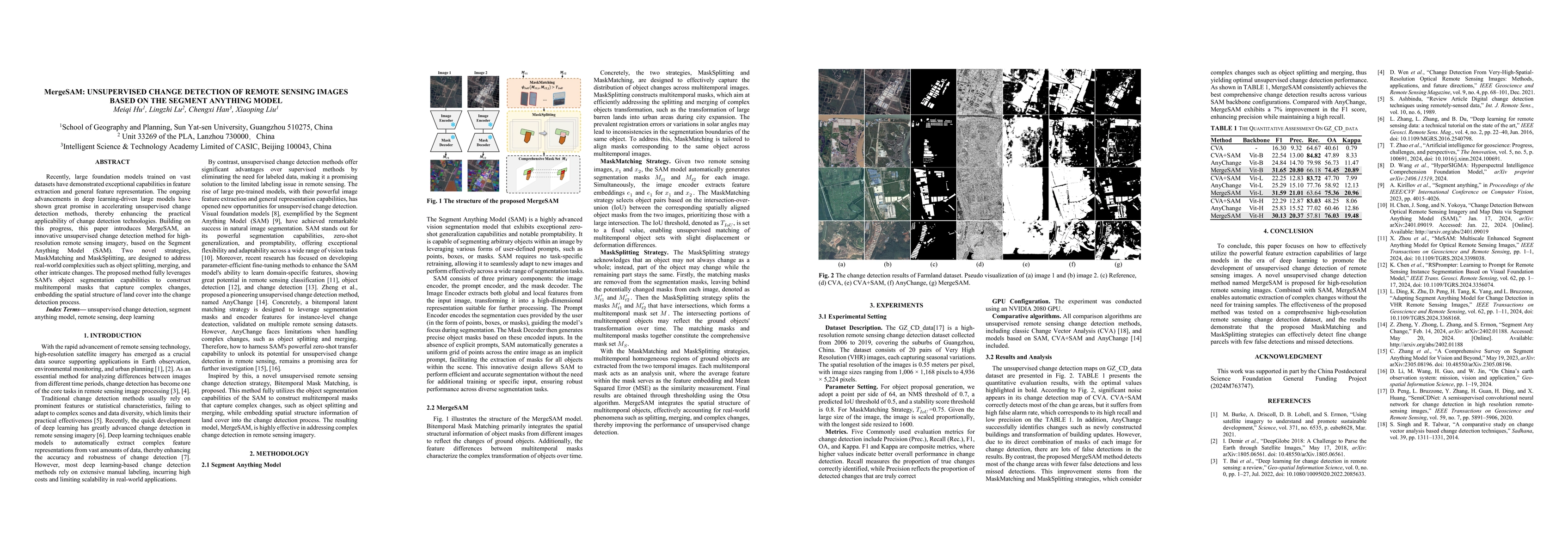
The research introduces MergeSAM, an unsupervised change detection method for high-resolution remote sensing imagery, based on the Segment Anything Model (SAM). It employs MaskMatching and MaskSplitting strategies to address complex changes like object splitting and merging, leveraging SAM's object segmentation capabilities to construct multitemporal masks.
Discussion 0