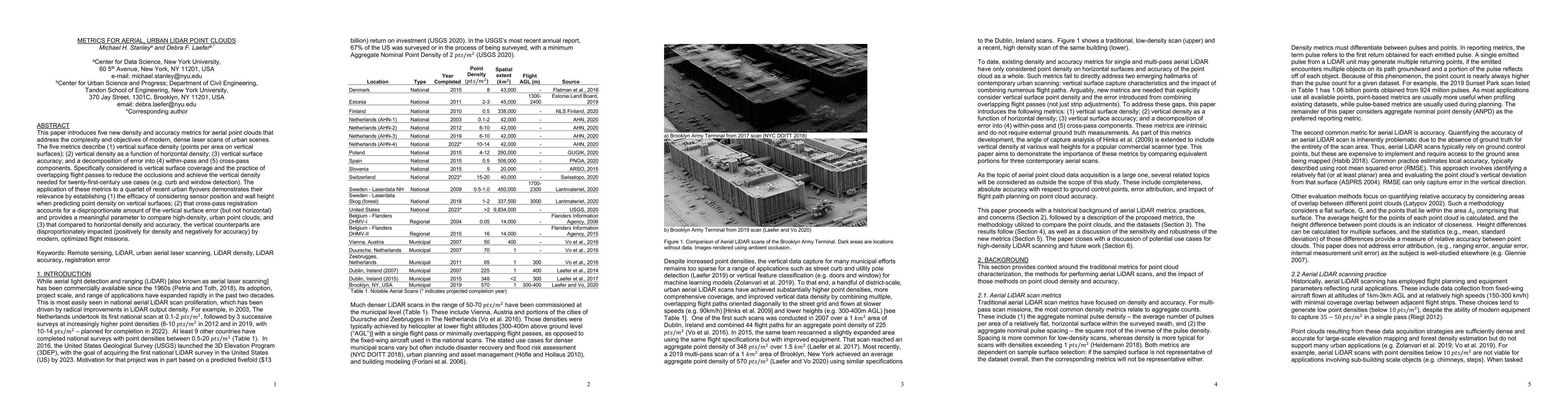
Metrics for Aerial, Urban LiDAR Point Clouds
Publication
Metrics
AI Quick Summary
New metrics for aerial LiDAR point clouds are introduced to improve vertical surface density and accuracy, addressing modern urban scans; these metrics help reduce occlusions and enhance use cases like curb detection.
Paper Preview
Abstract
This paper introduces five new density and accuracy metrics for aerial point clouds that address the complexity and objectives of modern, dense laser scans of urban scenes. The five metrics describe (1) vertical surface density (points per area on vertical surfaces); (2) vertical density as a function of horizontal density; (3) vertical surface accuracy; and a decomposition of error into (4) within-pass and (5) cross-pass components. Specifically considered is vertical surface coverage and the practice of overlapping flight passes to reduce the occlusions and achieve the vertical density needed for twenty-first-century use cases (e.g. curb and window detection). The application of these metrics to a quartet of recent urban flyovers demonstrates their relevance by establishing (1) the efficacy of considering sensor position and wall height when predicting point density on vertical surfaces; (2) that cross-pass registration accounts for a disproportionate amount of the vertical surface error (but not horizontal) and provides a meaningful parameter to compare high-density, urban point clouds; and (3) that compared to horizontal density and accuracy, the vertical counterparts are disproportionately impacted (positively for density and negatively for accuracy) by modern, optimized flight missions.
AI Key Findings
Get AI-generated insights about this paper's methodology, results, significance, and more — seven facets brought into focus.
Impact
Paper Details
Authors
PDF Preview
Key Terms
Citation Network
Current paper (gray), citations (green), references (blue)
Display is limited for performance on very large graphs.
Discussion 0