The use of robotics in humanitarian demining increasingly involves computer
vision techniques to improve landmine detection capabilities. However, in the
absence of diverse and realistic datasets, the reliable validation of
algorithms remains a challenge for the research community. In this paper, we
introduce MineInsight, a publicly available multi-sensor, multi-spectral
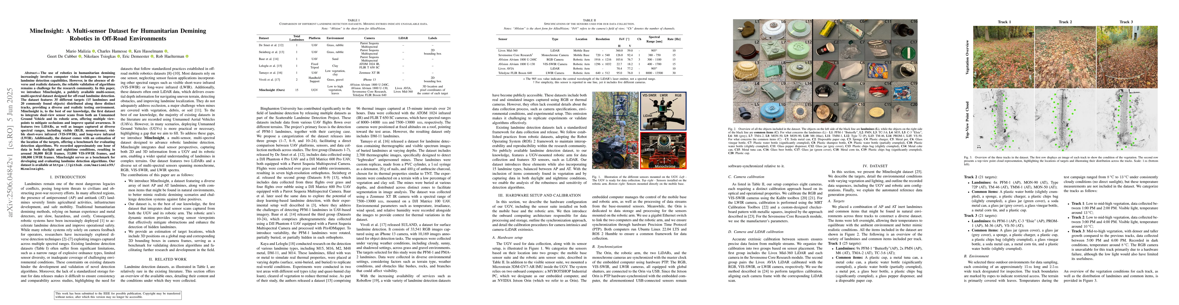
dataset designed for off-road landmine detection. The dataset features 35
different targets (15 landmines and 20 commonly found objects) distributed
along three distinct tracks, providing a diverse and realistic testing
environment. MineInsight is, to the best of our knowledge, the first dataset to
integrate dual-view sensor scans from both an Unmanned Ground Vehicle and its
robotic arm, offering multiple viewpoints to mitigate occlusions and improve
spatial awareness. It features two LiDARs, as well as images captured at
diverse spectral ranges, including visible (RGB, monochrome), visible
short-wave infrared (VIS-SWIR), and long-wave infrared (LWIR). Additionally,
the dataset comes with an estimation of the location of the targets, offering a
benchmark for evaluating detection algorithms. We recorded approximately one
hour of data in both daylight and nighttime conditions, resulting in around
38,000 RGB frames, 53,000 VIS-SWIR frames, and 108,000 LWIR frames. MineInsight
serves as a benchmark for developing and evaluating landmine detection
algorithms. Our dataset is available at
https://github.com/mariomlz99/MineInsight.
Discussion 0