Publication
Metrics
AI Quick Summary
The MIX-RS framework leverages HDFS for efficient storage of remote sensing data, utilizing multi-indexing to enhance geospatial indexing performance and fault tolerance, while minimizing overhead. Evaluations using real data show significant improvements in indexing efficiency.
Paper Preview
Abstract
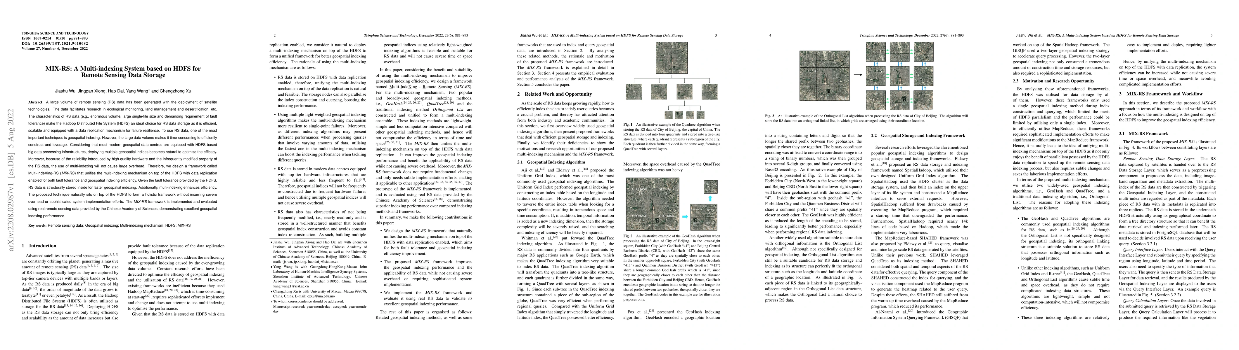
A large volume of remote sensing (RS) data has been generated with the deployment of satellite technologies. The data facilitates research in ecological monitoring, land management and desertification, etc. The characteristics of RS data (e.g., enormous volume, large single-file size and demanding requirement of fault tolerance) make the Hadoop Distributed File System (HDFS) an ideal choice for RS data storage as it is efficient, scalable and equipped with a data replication mechanism for failure resilience. To use RS data, one of the most important techniques is geospatial indexing. However, the large data volume makes it time-consuming to efficiently construct and leverage. Considering that most modern geospatial data centres are equipped with HDFS-based big data processing infrastructures, deploying multiple geospatial indices becomes natural to optimise the efficacy. Moreover, because of the reliability introduced by high-quality hardware and the infrequently modified property of the RS data, the use of multi-indexing will not cause large overhead. Therefore, we design a framework called Multi-IndeXing-RS (MIX-RS) that unifies the multi-indexing mechanism on top of the HDFS with data replication enabled for both fault tolerance and geospatial indexing efficiency. Given the fault tolerance provided by the HDFS, RS data is structurally stored inside for faster geospatial indexing. Additionally, multi-indexing enhances efficiency. The proposed technique naturally sits on top of the HDFS to form a holistic framework without incurring severe overhead or sophisticated system implementation efforts. The MIX-RS framework is implemented and evaluated using real remote sensing data provided by the Chinese Academy of Sciences, demonstrating excellent geospatial indexing performance.
AI Key Findings
Get AI-generated insights about this paper's methodology, results, significance, and more — seven facets brought into focus.
Impact
Paper Details
Authors
PDF Preview
Key Terms
Citation Network
Current paper (gray), citations (green), references (blue)
Display is limited for performance on very large graphs.
Discussion 0