MMLANDMARKS: a Cross-View Instance-Level Benchmark for Geo-Spatial Understanding
Publication
Metrics
Paper Preview
Abstract
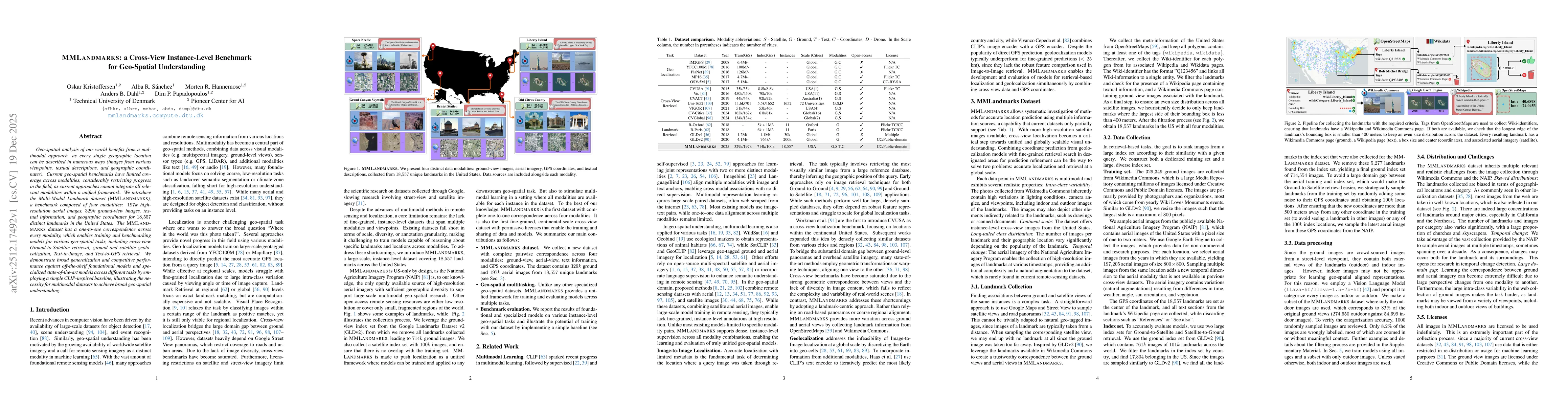
Geo-spatial analysis of our world benefits from a multimodal approach, as every single geographic location can be described in numerous ways (images from various viewpoints, textual descriptions, and geographic coordinates). Current geo-spatial benchmarks have limited coverage across modalities, considerably restricting progress in the field, as current approaches cannot integrate all relevant modalities within a unified framework. We introduce the Multi-Modal Landmark dataset (MMLANDMARKS), a benchmark composed of four modalities: 197k highresolution aerial images, 329k ground-view images, textual information, and geographic coordinates for 18,557 distinct landmarks in the United States. The MMLANDMARKS dataset has a one-to-one correspondence across every modality, which enables training and benchmarking models for various geo-spatial tasks, including cross-view Ground-to-Satellite retrieval, ground and satellite geolocalization, Text-to-Image, and Text-to-GPS retrieval. We demonstrate broad generalization and competitive performance against off-the-shelf foundational models and specialized state-of-the-art models across different tasks by employing a simple CLIP-inspired baseline, illustrating the necessity for multimodal datasets to achieve broad geo-spatial understanding.
AI Key Findings
Get AI-generated insights about this paper's methodology, results, significance, and more — seven facets brought into focus.
Discussion 0