Multi-Dimensional Geometric Complexity in Urban Transportation Systems
Publication
Metrics
AI Quick Summary
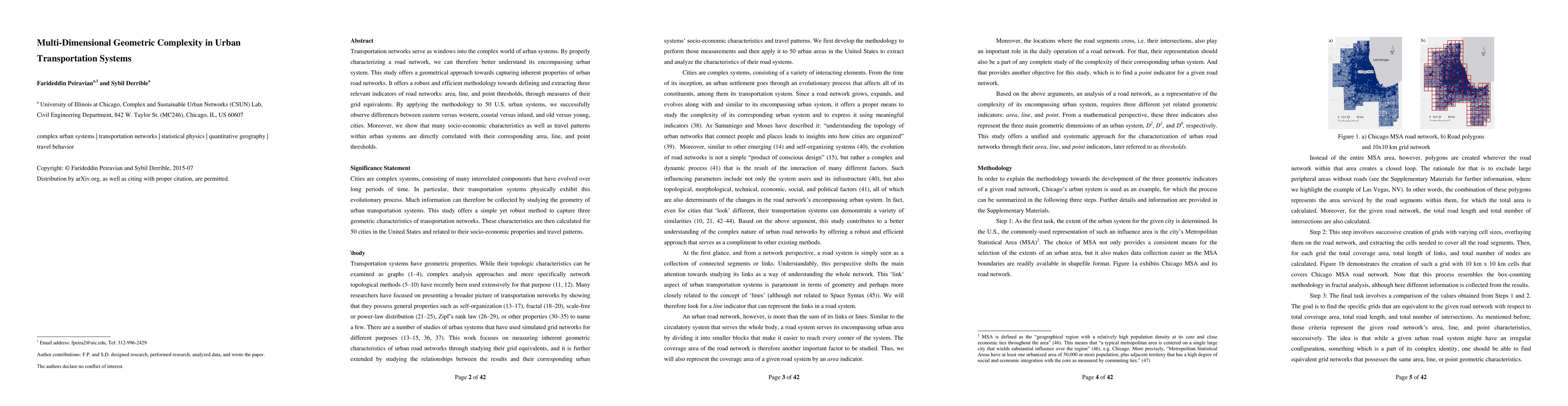
This study proposes a geometrical methodology to analyze urban road networks by defining three indicators: area, line, and point thresholds. Applying this approach to 50 U.S. cities reveals significant differences in transportation networks correlating with socio-economic characteristics and travel patterns.
Paper Preview
Abstract
Transportation networks serve as windows into the complex world of urban systems. By properly characterizing a road network, we can therefore better understand its encompassing urban system. This study offers a geometrical approach towards capturing inherent properties of urban road networks. It offers a robust and efficient methodology towards defining and extracting three relevant indicators of road networks: area, line, and point thresholds, through measures of their grid equivalents. By applying the methodology to 50 U.S. urban systems, we successfully observe differences between eastern versus western, coastal versus inland, and old versus young, cities. Moreover, we show that many socio-economic characteristics as well as travel patterns within urban systems are directly correlated with their corresponding area, line, and point thresholds.
AI Key Findings
Get AI-generated insights about this paper's methodology, results, significance, and more — seven facets brought into focus.
Impact
Paper Details
PDF Preview
Key Terms
Citation Network
Current paper (gray), citations (green), references (blue)
Display is limited for performance on very large graphs.
Discussion 0