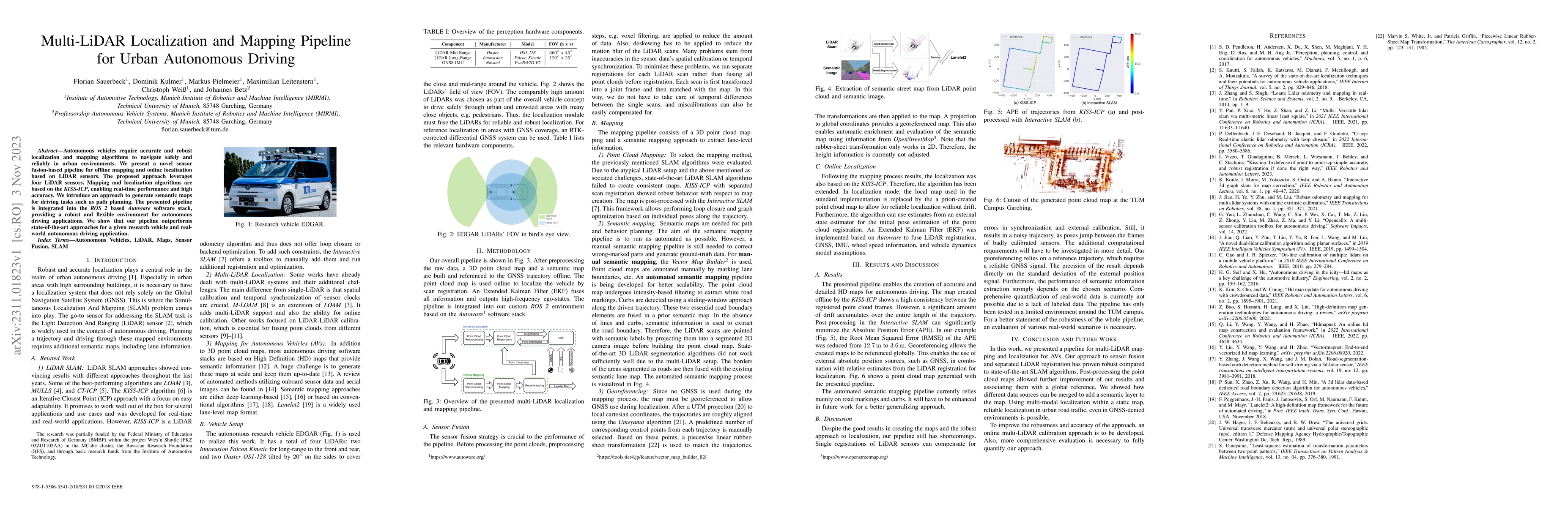
Multi-LiDAR Localization and Mapping Pipeline for Urban Autonomous Driving
Publication
Metrics
AI Quick Summary
This paper proposes a multi-LiDAR localization and mapping pipeline for urban autonomous driving, utilizing four LiDAR sensors and the KISS-ICP algorithm for real-time performance and high accuracy. The pipeline generates semantic maps for path planning and integrates into the ROS 2 based Autoware software stack, outperforming state-of-the-art methods.
Paper Preview
Abstract
Autonomous vehicles require accurate and robust localization and mapping algorithms to navigate safely and reliably in urban environments. We present a novel sensor fusion-based pipeline for offline mapping and online localization based on LiDAR sensors. The proposed approach leverages four LiDAR sensors. Mapping and localization algorithms are based on the KISS-ICP, enabling real-time performance and high accuracy. We introduce an approach to generate semantic maps for driving tasks such as path planning. The presented pipeline is integrated into the ROS 2 based Autoware software stack, providing a robust and flexible environment for autonomous driving applications. We show that our pipeline outperforms state-of-the-art approaches for a given research vehicle and real-world autonomous driving application.
AI Key Findings
Get AI-generated insights about this paper's methodology, results, significance, and more — seven facets brought into focus.
Impact
Paper Details
Authors
PDF Preview
Key Terms
Citation Network
Current paper (gray), citations (green), references (blue)
Display is limited for performance on very large graphs.
Discussion 0