The more than 200,000 glaciers outside the ice sheets play a crucial role in
our society by influencing sea-level rise, water resource management, natural
hazards, biodiversity, and tourism. However, only a fraction of these glaciers
benefit from consistent and detailed in-situ observations that allow for
assessing their status and changes over time. This limitation can, in part, be
overcome by relying on satellite-based Earth Observation techniques.
Satellite-based glacier mapping applications have historically mainly relied on
manual and semi-automatic detection methods, while recently, a fast and notable
transition to deep learning techniques has started.
This chapter reviews how combining multi-sensor remote sensing data and deep
learning allows us to better delineate (i.e. map) glaciers and detect their
temporal changes. We explain how relying on deep learning multi-sensor
frameworks to map glaciers benefits from the extensive availability of regional
and global glacier inventories. We also analyse the rationale behind glacier
mapping, the benefits of deep learning methodologies, and the inherent
challenges in integrating multi-sensor earth observation data with deep
learning algorithms.
While our review aims to provide a broad overview of glacier mapping efforts,
we highlight a few setups where deep learning multi-sensor remote sensing
applications have a considerable potential added value. This includes
applications for debris-covered and rock glaciers that are visually difficult
to distinguish from surroundings and for calving glaciers that are in contact
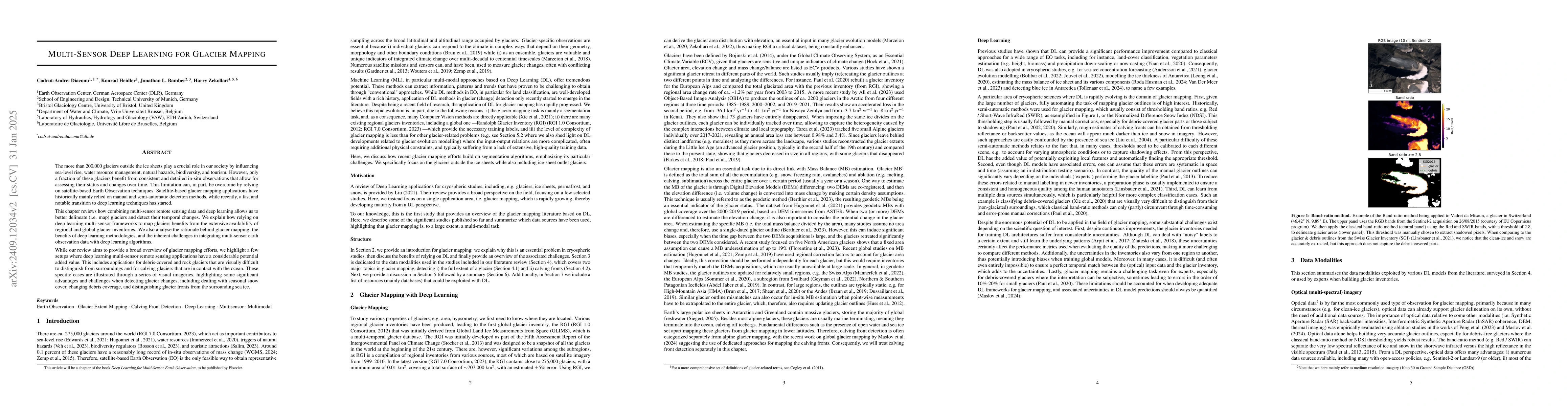
with the ocean. These specific cases are illustrated through a series of visual
imageries, highlighting some significant advantages and challenges when
detecting glacier changes, including dealing with seasonal snow cover, changing
debris coverage, and distinguishing glacier fronts from the surrounding sea
ice.
Discussion 0