We used 3D plane wave migration to image topography of the upper mantle
discontinuities at 410 km and 660 km depth that defines the transition zone. We
find both discontinuities have topography variation at all resolvable scales.
In this paper we examine the dependency of discontinuity roughness on
tomography models. We migrated a common USArray data set with a selection of
regional, global, surface wave, and body wave tomography models to distinguish
different scales of roughness. The objective is to appraise what features are
potential artifact from using an inaccurate velocity model. We find that the
largest-scale features depend on the choice of tomography model, while
smaller-scale features appear to be almost completely independent of current
generation models. We suggest that this observation is additional evidence of
the existence of small-scale roughness on the upper mantle discontinuities not
captured with the data sampling density of the USArray. We find all models
based only on body wave travel times alone do not remove a continent scale
offset of both discontinuities that correlates with the edge of the craton. We
conclude that offset is an artifact linked to underestimation of wave speed in
the upper mantle by pure body wave models. Models produced by joint inversion
with surface wave dispersion data are less prone to this apparent artifact. The
large-scale topography variation is consistent with rigid plate motion models
of the subducted Farallon slab underneath North American. Smaller scale
topography is found to have larger variation in regions where the vertical
mantle flow through the transition zone is implied by transition zone
thickness.
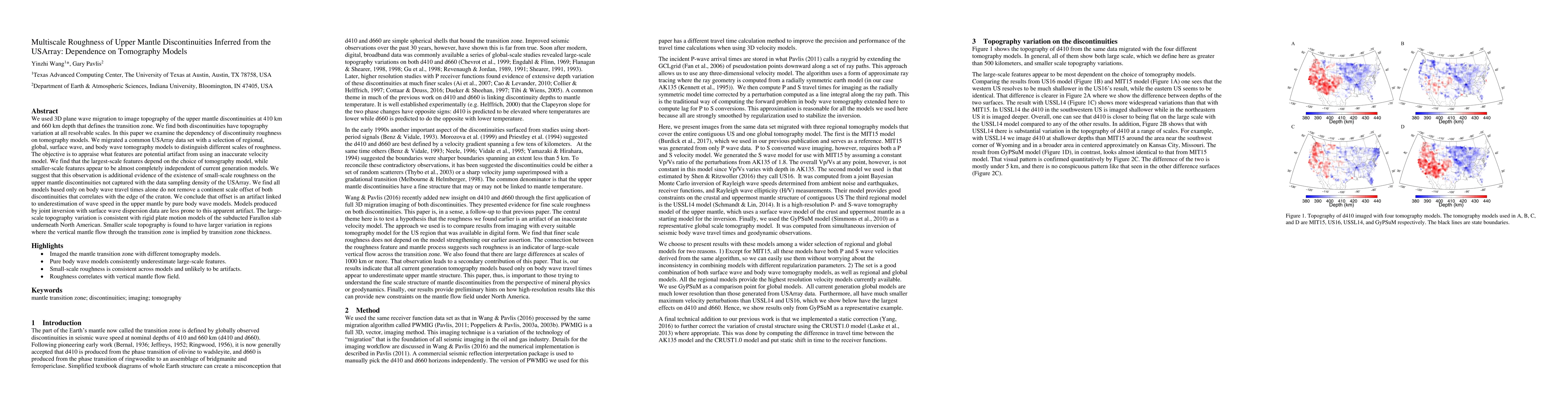
Discussion 0