Object level footprint uncertainty quantification in infrastructure based sensing
Publication
Metrics
AI Quick Summary
This paper develops a method to quantify footprint uncertainty for objects imaged by infrastructure-based camera sensing, establishing a closed-form relationship between ground coordinates and camera errors. It uses error propagation to measure the covariance of ground coordinates and estimates typical error sizes through an experiment with high-precision LiDAR, demonstrating the approach with a simulated case study in CARLA.
Paper Preview
Abstract
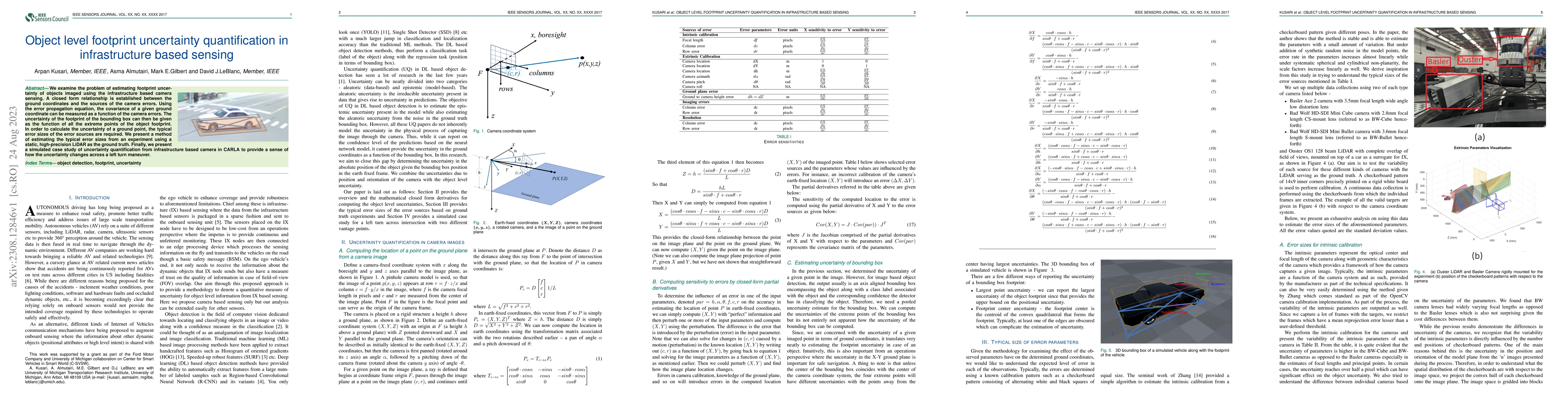
We examine the problem of estimating footprint uncertainty of objects imaged using the infrastructure based camera sensing. A closed form relationship is established between the ground coordinates and the sources of the camera errors. Using the error propagation equation, the covariance of a given ground coordinate can be measured as a function of the camera errors. The uncertainty of the footprint of the bounding box can then be given as the function of all the extreme points of the object footprint. In order to calculate the uncertainty of a ground point, the typical error sizes of the error sources are required. We present a method of estimating the typical error sizes from an experiment using a static, high-precision LiDAR as the ground truth. Finally, we present a simulated case study of uncertainty quantification from infrastructure based camera in CARLA to provide a sense of how the uncertainty changes across a left turn maneuver.
AI Key Findings
Get AI-generated insights about this paper's methodology, results, significance, and more — seven facets brought into focus.
Impact
Paper Details
Authors
PDF Preview
Key Terms
Citation Network
Current paper (gray), citations (green), references (blue)
Display is limited for performance on very large graphs.
Discussion 0