OGInfra: Geolocating Oil & Gas Infrastructure using Remote Sensing based Active Fire Data
Publication
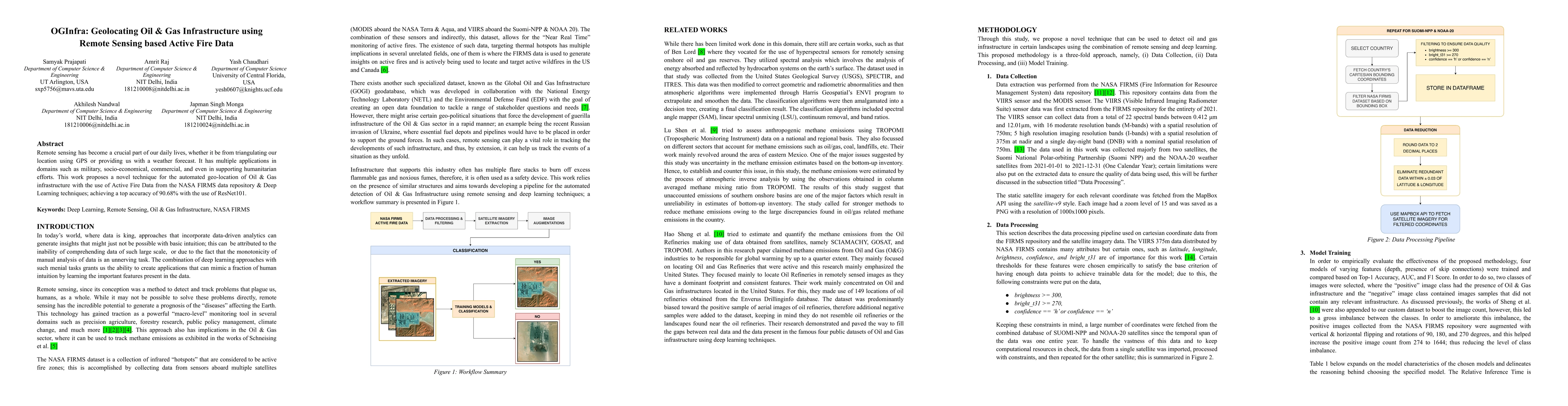
Metrics
AI Quick Summary
Summary: OGInfra proposes a novel method using NASA FIRMS active fire data and ResNet101 deep learning to automate geolocation of Oil & Gas infrastructure, achieving 90.68% accuracy. This technique leverages remote sensing for enhanced monitoring and management of critical energy infrastructure.
Paper Preview
Abstract
Remote sensing has become a crucial part of our daily lives, whether it be from triangulating our location using GPS or providing us with a weather forecast. It has multiple applications in domains such as military, socio-economical, commercial, and even in supporting humanitarian efforts. This work proposes a novel technique for the automated geo-location of Oil & Gas infrastructure with the use of Active Fire Data from the NASA FIRMS data repository & Deep Learning techniques; achieving a top accuracy of 90.68% with the use of ResNet101.
AI Key Findings
Get AI-generated insights about this paper's methodology, results, significance, and more — seven facets brought into focus.
Impact
Paper Details
Authors
PDF Preview
Key Terms
Citation Network
Current paper (gray), citations (green), references (blue)
Display is limited for performance on very large graphs.
Discussion 0