01
MethodologyHow they did it
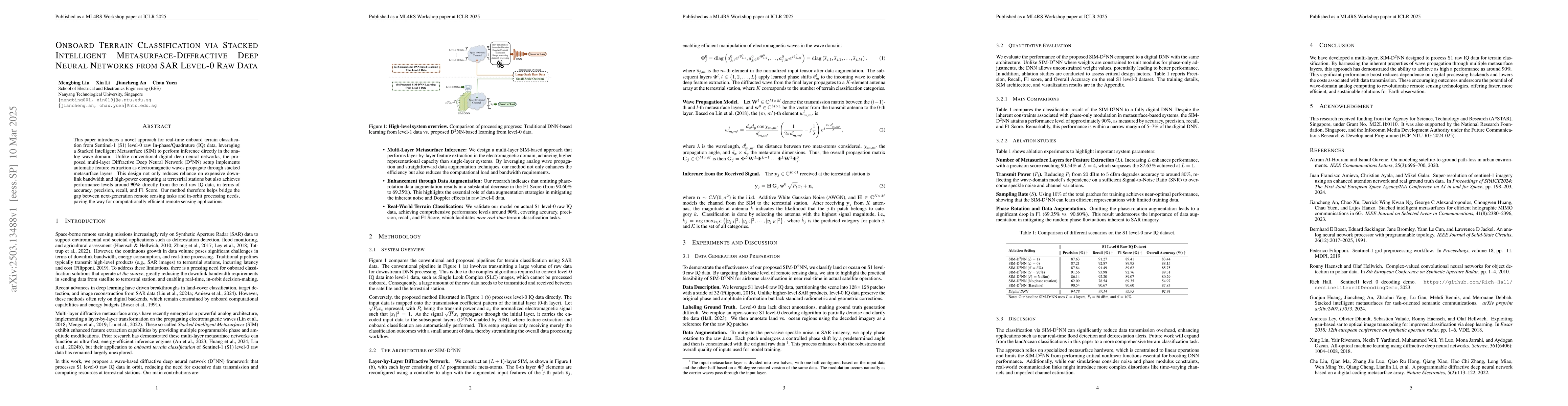
The research introduces a novel approach for real-time onboard terrain classification from Sentinel-1 (S1) level-0 raw In-phase/Quadrature (IQ) data using a Stacked Intelligent Metasurface (SIM) that performs inference directly in the analog wave domain, implementing automatic feature extraction as electromagnetic waves propagate through stacked metasurface layers.
Discussion 0