01
MethodologyHow they did it
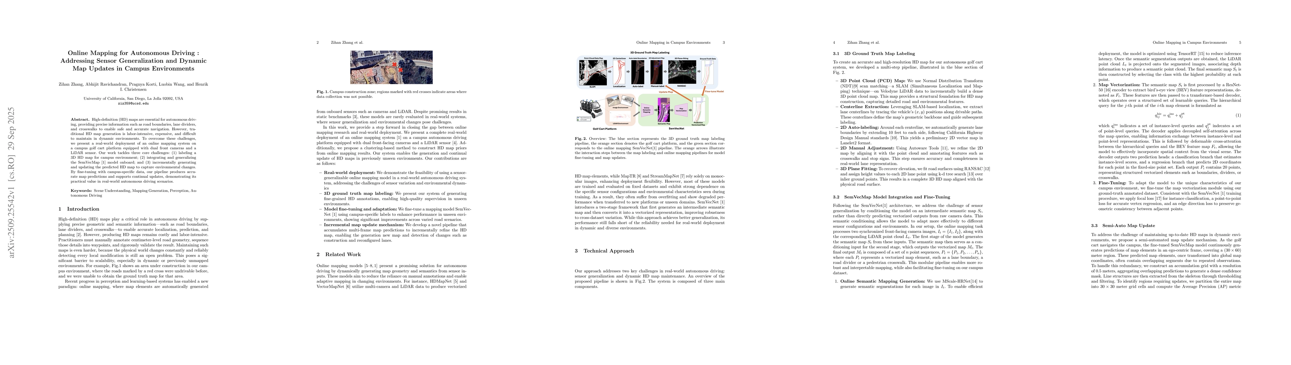
The research presents an online mapping system for autonomous driving in campus environments, integrating dual front cameras and LiDAR sensors. It employs a multi-step pipeline for 3D HD map labeling, semantic segmentation, and vectorization using the SemVecMap model, with fine-tuning on campus-specific data. The system also includes a semi-automated map update mechanism using accumulation grids and AP metrics for detecting environmental changes.
Discussion 0