Rapid evolution of territories due to climate change and human impact
requires prompt and effective updates to geospatial databases maintained by the
National Mapping Agency. This paper presents a comprehensive overview of change
detection methods tailored for the operational updating of large-scale
geographic databases. This review first outlines the fundamental definition of
change, emphasizing its multifaceted nature, from temporal to semantic
characterization. It categorizes automatic change detection methods into four
main families: rule-based, statistical, machine learning, and simulation
methods. The strengths, limitations, and applicability of every family are
discussed in the context of various input data. Then, key applications for
National Mapping Agencies are identified, particularly the optimization of
geospatial database updating, change-based phenomena, and dynamics monitoring.
Finally, the paper highlights the current challenges for leveraging change
detection such as the variability of change definition, the missing of relevant
large-scale datasets, the diversity of input data, the unstudied no-change
detection, the human in the loop integration and the operational constraints.
The discussion underscores the necessity for ongoing innovation in change
detection techniques to address the future needs of geographic information
systems for national mapping agencies.
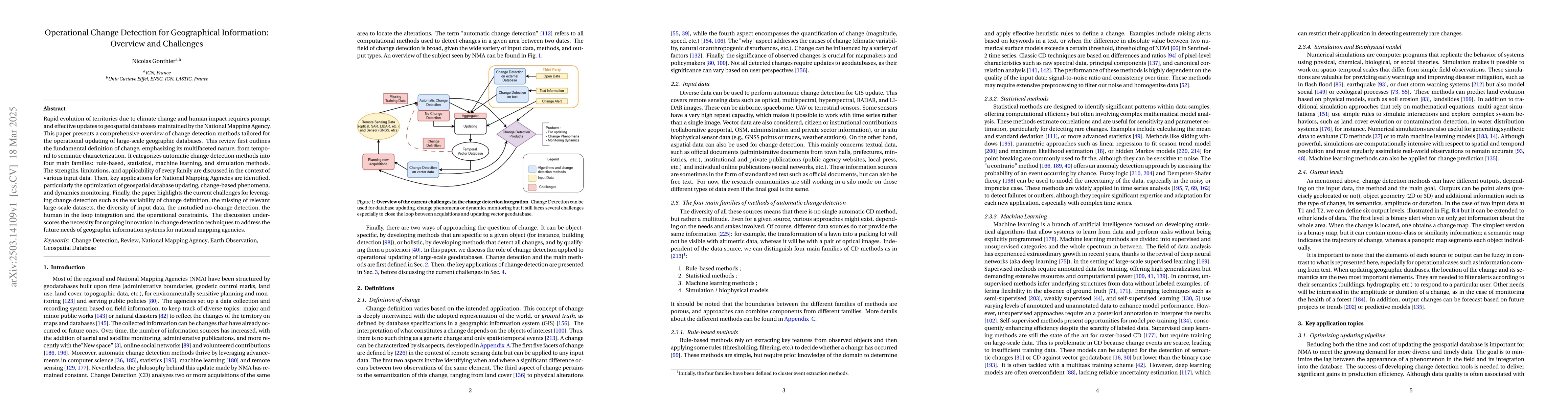
Discussion 0