Optimal Placement of Base Stations in Border Surveillance using Limited Capacity Drones
Publication
Metrics
AI Quick Summary
This paper presents algorithms for optimally placing base stations along the boundary of an island to enable drones to monitor the coastline without running out of fuel, considering limited drone range and capacity. The proposed methods achieve near-optimal solutions with polynomial time complexity and include a heuristic for certifying optimality.
Paper Preview
Abstract
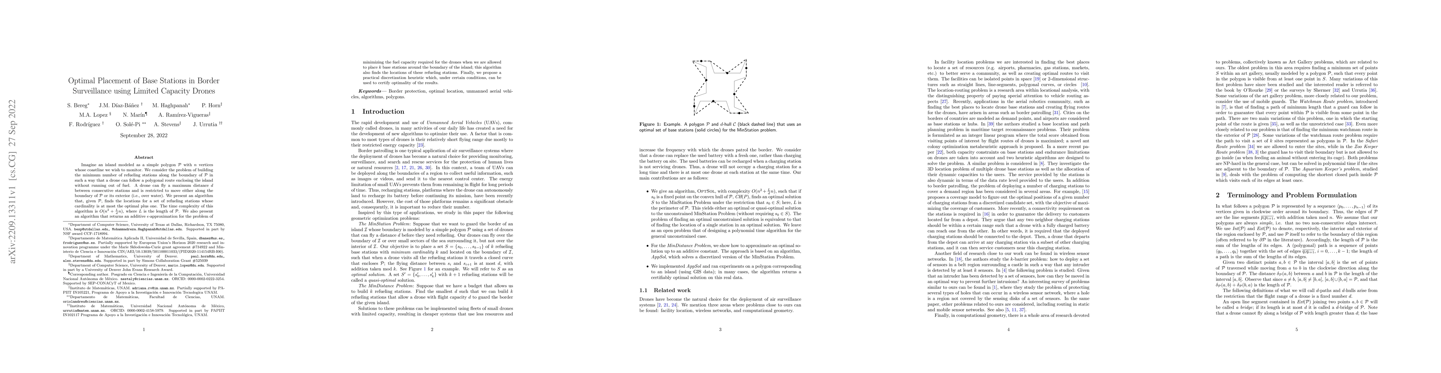
Imagine an island modeled as a simple polygon $\P$ with $n$ vertices whose coastline we wish to monitor. We consider the problem of building the minimum number of refueling stations along the boundary of $\P$ in such a way that a drone can follow a polygonal route enclosing the island without running out of fuel. A drone can fly a maximum distance $d$ between consecutive stations and is restricted to move either along the boundary of $\P$ or its exterior (i.e., over water). We present an algorithm that, given $\mathcal P$, finds the locations for a set of refueling stations whose cardinality is at most the optimal plus one. The time complexity of this algorithm is $O(n^2 + \frac{L}{d} n)$, where $L$ is the length of $\mathcal P$. We also present an algorithm that returns an additive $\epsilon$-approximation for the problem of minimizing the fuel capacity required for the drones when we are allowed to place $k$ base stations around the boundary of the island; this algorithm also finds the locations of these refueling stations. Finally, we propose a practical discretization heuristic which, under certain conditions, can be used to certify optimality of the results.
AI Key Findings
Get AI-generated insights about this paper's methodology, results, significance, and more — seven facets brought into focus.
Impact
Paper Details
Authors
PDF Preview
Key Terms
Citation Network
Current paper (gray), citations (green), references (blue)
Display is limited for performance on very large graphs.
Discussion 0