Optimized Deployment of Autonomous Drones to Improve User Experience in Cellular Networks
Publication
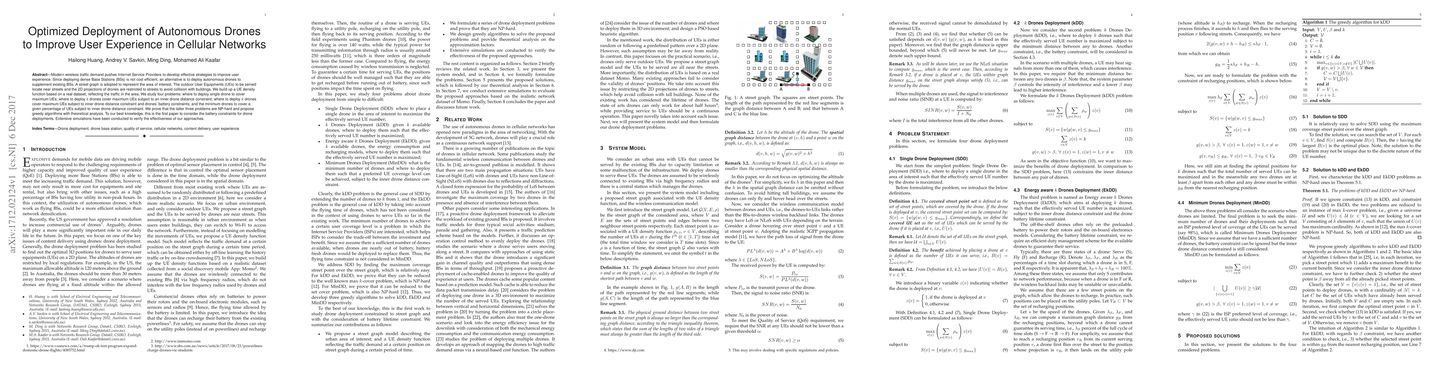
Metrics
Paper Preview
Abstract
Modern wireless traffic demand pushes Internet Service Providers to develop effective strategies to improve user experience. Since deploying dense Base Stations (BSs) is not cost efficient, an alternative is to deploy autonomous drones to supplement existing BSs. A street graph is adopted to represent the area of interest. The outdoor User Equipments (UEs) to be served locate near streets and the 2D projections of drones are restricted to streets to avoid collision with buildings. We build up a UE density function based on a real dataset, reflecting the traffic in the area. We study four problems: where to deploy single drone to cover maximum UEs, where to deploy $k$ drones cover maximum UEs subject to an inner drone distance constraint, where to deploy $k$ drones cover maximum UEs subject to inner drone distance constraint and drones' battery constraints, and the minimum drones to cover a given percentage of UEs subject to inner drone distance constraint. We prove that the latter three problems are NP-hard and propose greedy algorithms with theoretical analysis. To our best knowledge, this is the first paper to consider the battery constraints for drone deployments. Extensive simulations have been conducted to verify the effectiveness of our approaches.
AI Key Findings
Get AI-generated insights about this paper's methodology, results, significance, and more — seven facets brought into focus.
Impact
Paper Details
PDF Preview
Key Terms
Citation Network
Current paper (gray), citations (green), references (blue)
Display is limited for performance on very large graphs.
Discussion 0