Summary
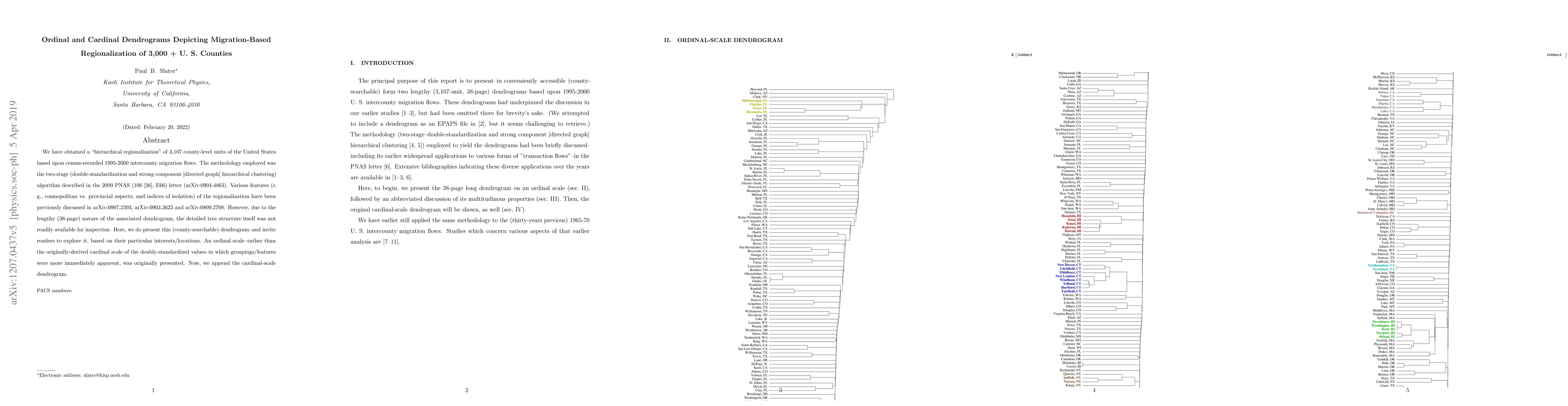
We have obtained a "hierarchical regionalization" of 3,107 county-level units of the United States based upon census-recorded 1995-2000 intercounty migration flows. The methodology employed was the two-stage (double-standardization and strong component [directed graph] hierarchical clustering) algorithm described in the 2009 PNAS (106 [26], E66) letter (arXiv:0904.4863). Various features (e. g., cosmopolitan vs. provincial aspects, and indices of isolation) of the regionalization have been previously discussed in arXiv:0907.2393, arXiv:0903.3623 and arXiv:0809.2768. However, due to the lengthy (38-page) nature of the associated dendrogram, the detailed tree structure itself was not readily available for inspection. Here, we do present this (county-searchable) dendrogram--and invite readers to explore it, based on their particular interests/locations. An ordinal scale--rather than the originally-derived cardinal scale of the doubly-standardized values--in which groupings/features were more immediately apparent, was originally presented. Now, we append the cardinal-scale dendrogram.
AI Key Findings
Get AI-generated insights about this paper's methodology, results, and significance.
Paper Details
PDF Preview
Key Terms
Citation Network
Current paper (gray), citations (green), references (blue)
Display is limited for performance on very large graphs.
Similar Papers
Found 4 papersOnline Ordinal Problems: Optimality of Comparison-based Algorithms and their Cardinal Complexity
Zhihao Gavin Tang, Nick Gravin, Enze Sun
No citations found for this paper.
Comments (0)