01
MethodologyHow they did it
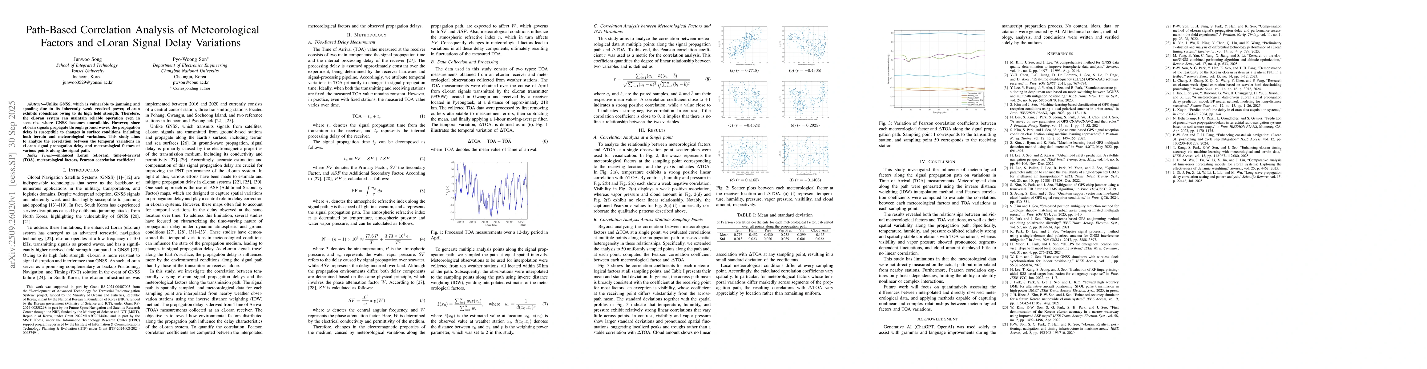
The study employed a path-based correlation analysis to examine the relationship between meteorological factors and eLoran signal delay variations. It used Time of Arrival (TOA) measurements from an eLoran receiver and interpolated meteorological data from nearby weather stations using inverse distance weighting (IDW). Pearson correlation coefficients were calculated to assess the linear relationships between meteorological variables and TOA variations at multiple points along the signal path.
Discussion 0