This paper analyzes the effectiveness of spatial ASF correction methods in the Korean eLoran system using measured ASF maps. Three correction scenarios were evaluated under identical simulation settings: no correction (S0), local correction using true ASF values (S1), and wide-area correction using a single reference station value (S2). Simulation results show that S1 consistently achieved the lowest positioning errors, while S0 exhibited the largest errors with extensive high-error regions. S2 provided limited improvements near the reference station but degraded with increasing distance and ASF spatial gradients. The findings highlight that local ASF correction significantly improves eLoran positioning performance, whereas wide-area correction has only localized benefits.
Generated Oct 01, 2025
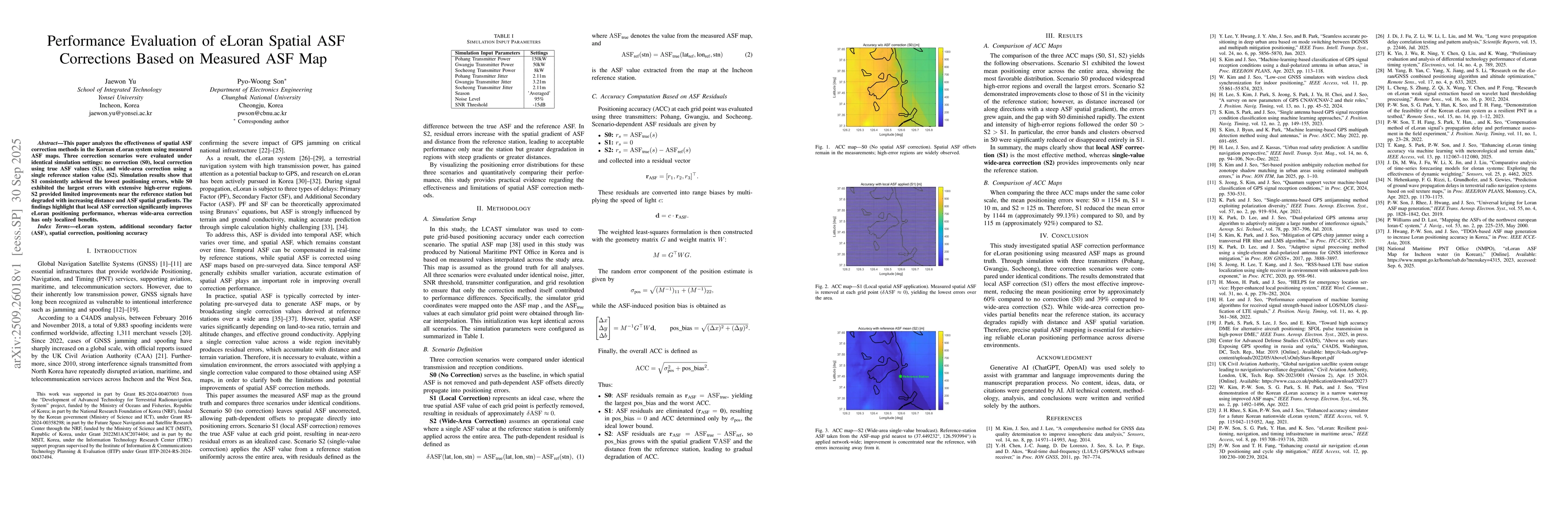
The study used a simulation environment with three correction scenarios (S0, S1, S2) based on measured ASF maps. The LCAST simulator was employed to evaluate grid-based positioning accuracy under identical noise, jitter, SNR thresholds, and transmitter configurations.
This research highlights the critical role of local ASF correction in improving eLoran positioning accuracy, providing practical insights for enhancing resilient PNT systems against GNSS vulnerabilities.
The paper provides a systematic evaluation of spatial ASF correction methods using measured ASF maps as ground truth, establishing a framework for comparing correction techniques in eLoran systems.
This work is novel in its use of measured ASF maps as ground truth for evaluating spatial correction methods, combined with a detailed simulation setup that isolates the impact of different correction strategies on positioning accuracy.
Comments (0)