Planarity and Street Network Representation in Urban Form Analysis
Publication
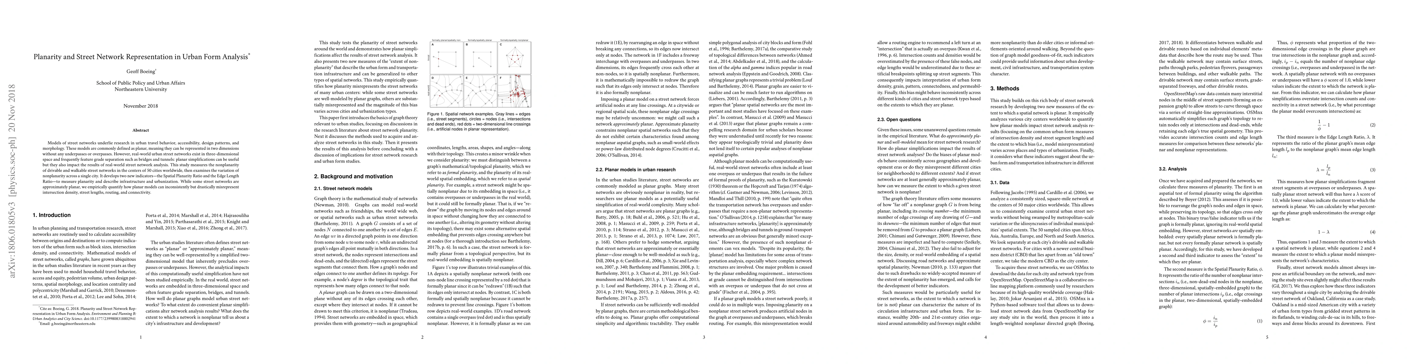
Metrics
AI Quick Summary
This study measures the nonplanarity of urban street networks in 50 cities worldwide, developing new indicators to quantify planarity impacts. It finds that while some street networks are nearly planar, planar simplifications can significantly misrepresent intersection density, street lengths, routing, and connectivity.
Paper Preview
Abstract
Models of street networks underlie research in urban travel behavior, accessibility, design patterns, and morphology. These models are commonly defined as planar, meaning they can be represented in two dimensions without any underpasses or overpasses. However, real-world urban street networks exist in three-dimensional space and frequently feature grade separation such as bridges and tunnels: planar simplifications can be useful but they also impact the results of real-world street network analysis. This study measures the nonplanarity of drivable and walkable street networks in the centers of 50 cities worldwide, then examines the variation of nonplanarity across a single city. It develops two new indicators - the Spatial Planarity Ratio and the Edge Length Ratio - to measure planarity and describe infrastructure and urbanization. While some street networks are approximately planar, we empirically quantify how planar models can inconsistently but drastically misrepresent intersection density, street lengths, routing, and connectivity.
AI Key Findings
Get AI-generated insights about this paper's methodology, results, significance, and more — seven facets brought into focus.
Impact
Paper Details
PDF Preview
Key Terms
Citation Network
Current paper (gray), citations (green), references (blue)
Display is limited for performance on very large graphs.
Discussion 0