Publication
Metrics
AI Quick Summary
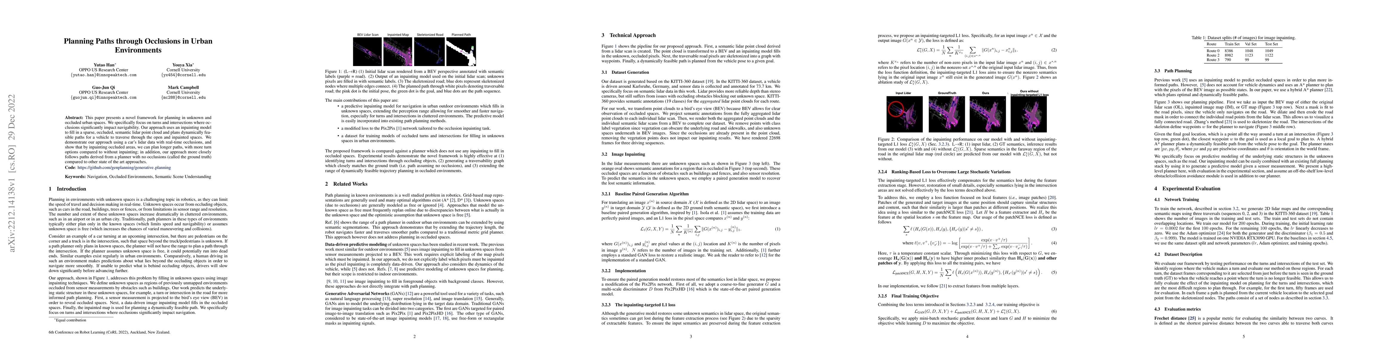
This paper introduces a framework for navigating unknown urban environments with occlusions, using an inpainting model to fill in occluded areas in lidar data and plan feasible paths. The approach demonstrates improved path planning with more turn options and closer adherence to ground truth paths compared to existing methods.
Paper Preview
Abstract
This paper presents a novel framework for planning in unknown and occluded urban spaces. We specifically focus on turns and intersections where occlusions significantly impact navigability. Our approach uses an inpainting model to fill in a sparse, occluded, semantic lidar point cloud and plans dynamically feasible paths for a vehicle to traverse through the open and inpainted spaces. We demonstrate our approach using a car's lidar data with real-time occlusions, and show that by inpainting occluded areas, we can plan longer paths, with more turn options compared to without inpainting; in addition, our approach more closely follows paths derived from a planner with no occlusions (called the ground truth) compared to other state of the art approaches.
AI Key Findings
Get AI-generated insights about this paper's methodology, results, significance, and more — seven facets brought into focus.
Impact
Paper Details
Authors
PDF Preview
Key Terms
Citation Network
Current paper (gray), citations (green), references (blue)
Display is limited for performance on very large graphs.
Discussion 0