Publication
Metrics
AI Quick Summary
Researchers have created an open-source dataset of polarimetric SAR images of San Francisco, annotating them for image classification and segmentation to support scientific research.
Paper Preview
Abstract
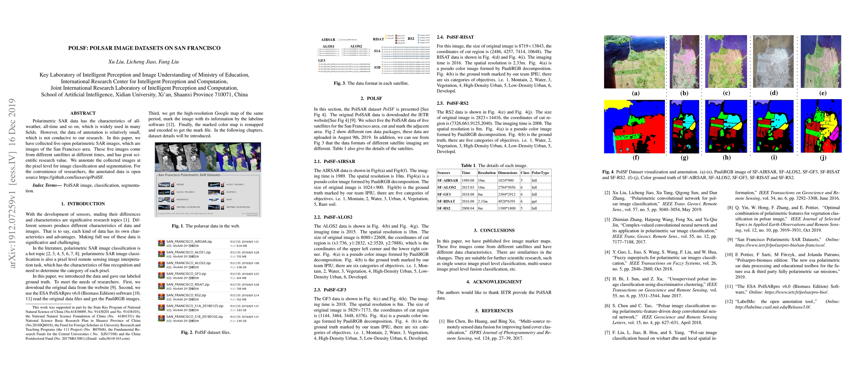
Polarimetric SAR data has the characteristics of all-weather, all-time and so on, which is widely used in many fields. However, the data of annotation is relatively small, which is not conducive to our research. In this paper, we have collected five open polarimetric SAR images, which are images of the San Francisco area. These five images come from different satellites at different times, which has great scientific research value. We annotate the collected images at the pixel level for image classification and segmentation. For the convenience of researchers, the annotated data is open source https://github.com/liuxuvip/PolSF.
AI Key Findings
Get AI-generated insights about this paper's methodology, results, significance, and more — seven facets brought into focus.
Impact
Paper Details
Authors
PDF Preview
Key Terms
Citation Network
Current paper (gray), citations (green), references (blue)
Display is limited for performance on very large graphs.
Discussion 0