Population estimation is crucial for various applications, from resource
allocation to urban planning. Traditional methods such as surveys and censuses
are expensive, time-consuming and also heavily dependent on human resources,
requiring significant manpower for data collection and processing. In this
study a deep learning solution is proposed to estimate population using high
resolution (0.3 m) satellite imagery, Digital Elevation Models (DEM) of 0.5m
resolution and vector boundaries. Proposed method combines Convolution Neural
Network (CNN) architecture for classification task to classify buildings as
residential and non-residential and Artificial Neural Network (ANN)
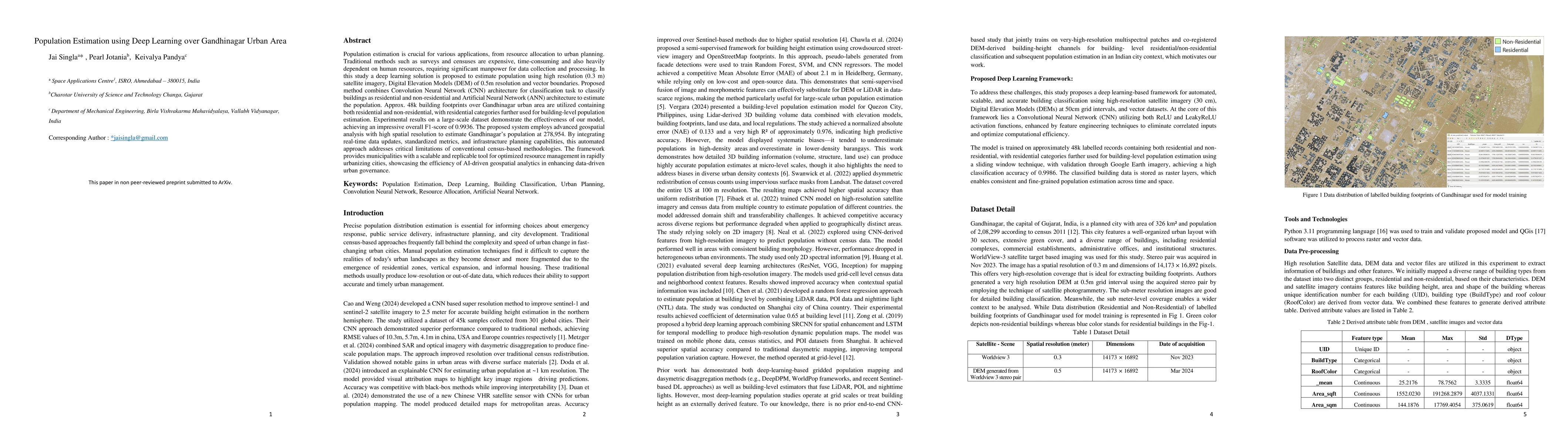
architecture to estimate the population. Approx. 48k building footprints over
Gandhinagar urban area are utilized containing both residential and
non-residential, with residential categories further used for building-level
population estimation. Experimental results on a large-scale dataset
demonstrate the effectiveness of our model, achieving an impressive overall
F1-score of 0.9936. The proposed system employs advanced geospatial analysis
with high spatial resolution to estimate Gandhinagar population at 278,954. By
integrating real-time data updates, standardized metrics, and infrastructure
planning capabilities, this automated approach addresses critical limitations
of conventional census-based methodologies. The framework provides
municipalities with a scalable and replicable tool for optimized resource
management in rapidly urbanizing cities, showcasing the efficiency of AI-driven
geospatial analytics in enhancing data-driven urban governance.
Discussion 0