Positioning aiding using LiDAR in GPS signal loss scenarios
Publication
Metrics
AI Quick Summary
Researchers developed a sensor data processing scheme to improve positioning accuracy for an autonomous surface vehicle in GPS signal loss scenarios. They used LiDAR data to fill gaps in positioning data generated through scan matching and registration.
Paper Preview
Abstract
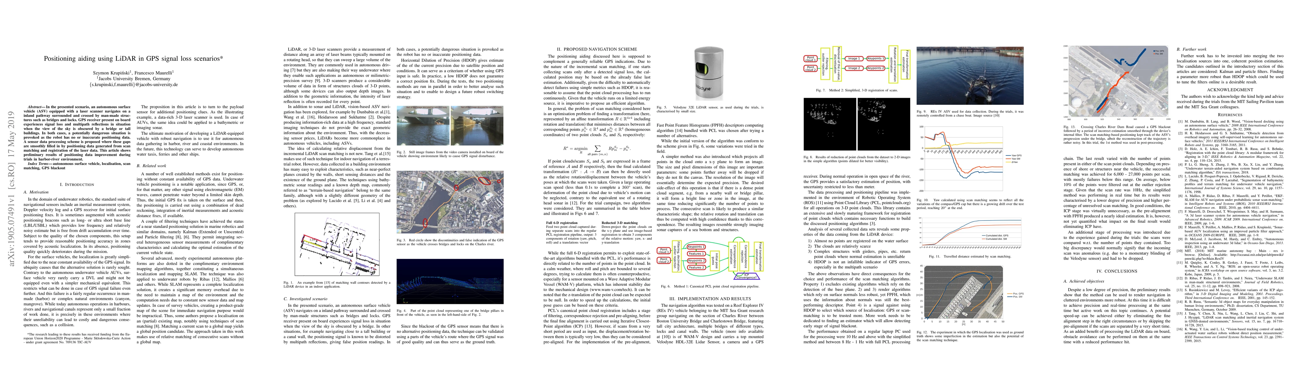
In the presented scenario, an autonomous surface vehicle (ASV) equipped with a laser scanner navigates on a inland pathway surrounded and crossed by man-made structures such as bridges and locks. {GPS} receiver present on board experiences signal loss and multipath reflections in situation when the view of the sky is obscured by a bridge or tall buildings. In both cases, a potentially dangerous situation is provoked as the robot has no or inaccurate positioning data. A sensor data processing scheme is proposed where these gaps are smoothly filled in by positioning data generated from scan matching and registration of the laser data. This article shows preliminary results of positioning data improvement during trials in harbor-river environment.
AI Key Findings
Get AI-generated insights about this paper's methodology, results, significance, and more — seven facets brought into focus.
Impact
Paper Details
PDF Preview
Key Terms
Citation Network
Current paper (gray), citations (green), references (blue)
Display is limited for performance on very large graphs.
Discussion 0