Potential UAV Landing Sites Detection through Digital Elevation Models Analysis
Publication
Metrics
AI Quick Summary
This paper presents a method for detecting potential UAV landing sites using digital elevation models (DEM) to identify flat areas. The algorithm processes the digital surface model (DSM) to find suitable landing zones, excluding man-made structures and vegetation, and demonstrates superior performance compared to existing techniques.
Paper Preview
Abstract
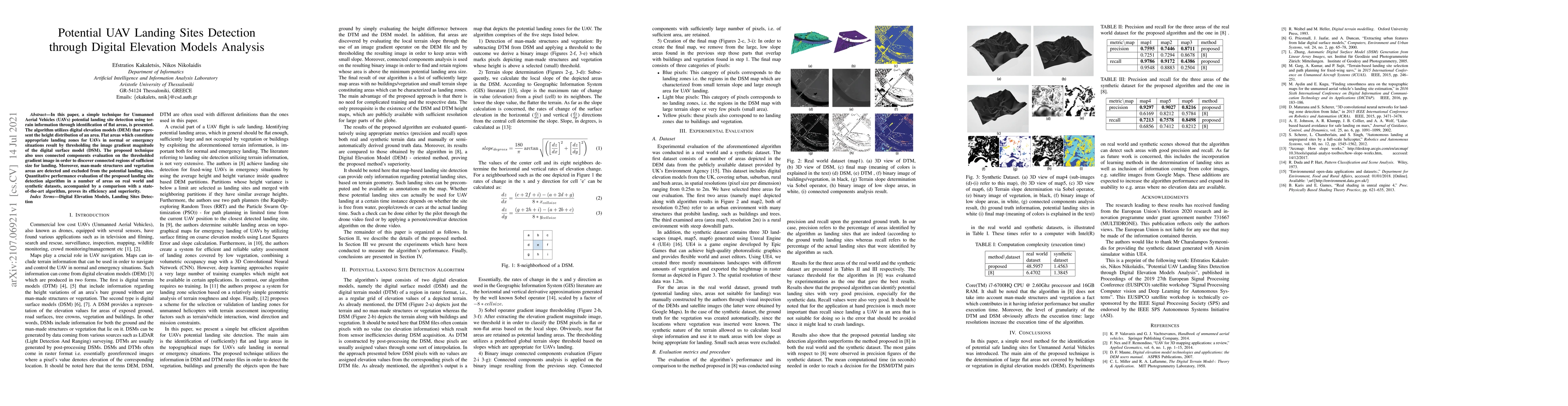
In this paper, a simple technique for Unmanned Aerial Vehicles (UAVs) potential landing site detection using terrain information through identification of flat areas, is presented. The algorithm utilizes digital elevation models (DEM) that represent the height distribution of an area. Flat areas which constitute appropriate landing zones for UAVs in normal or emergency situations result by thresholding the image gradient magnitude of the digital surface model (DSM). The proposed technique also uses connected components evaluation on the thresholded gradient image in order to discover connected regions of sufficient size for landing. Moreover, man-made structures and vegetation areas are detected and excluded from the potential landing sites. Quantitative performance evaluation of the proposed landing site detection algorithm in a number of areas on real world and synthetic datasets, accompanied by a comparison with a state-of-the-art algorithm, proves its efficiency and superiority.
AI Key Findings
Get AI-generated insights about this paper's methodology, results, significance, and more — seven facets brought into focus.
Impact
Paper Details
Authors
PDF Preview
Key Terms
Citation Network
Current paper (gray), citations (green), references (blue)
Display is limited for performance on very large graphs.
Discussion 0