Predicting GNSS satellite visibility from dense point clouds
Publication
Metrics
Paper Preview
Abstract
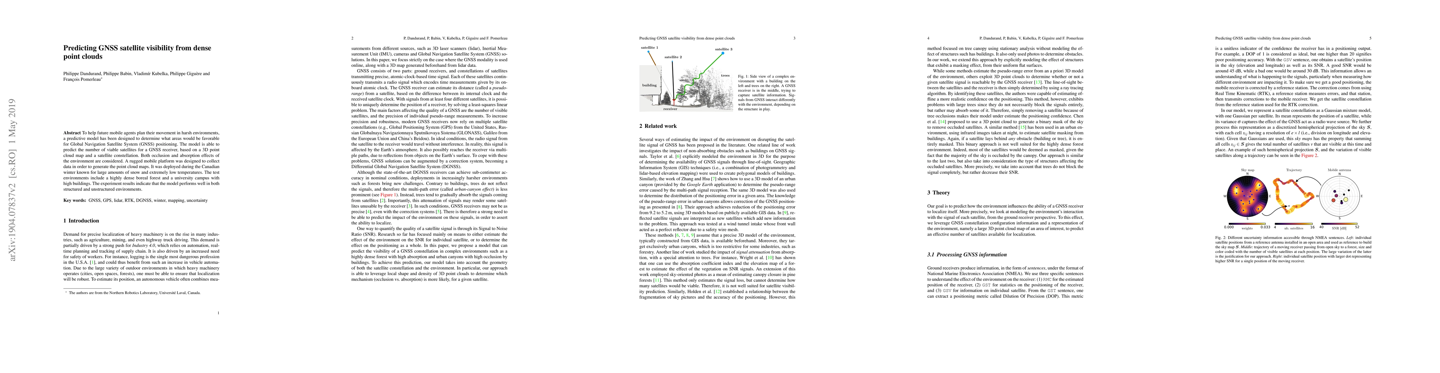
To help future mobile agents plan their movement in harsh environments,a predictive model has been designed to determine what areas would be favorable for Global Navigation Satellite System (GNSS) positioning. The model is able to predict the number of viable satellites for a GNSS receiver, based on a 3D point cloud map and a satellite constellation. Both occlusion and absorption effects of the environment are considered. A rugged mobile platform was designed to collect data in order to generate the point cloud maps. It was deployed during the Canadian winter known for large amounts of snow and extremely low temperatures. The test environments include a highly dense boreal forest and a university campus with high buildings. The experiment results indicate that the model performs well in both structured and unstructured environments
AI Key Findings
Get AI-generated insights about this paper's methodology, results, significance, and more — seven facets brought into focus.
Impact
Paper Details
PDF Preview
Key Terms
Citation Network
Current paper (gray), citations (green), references (blue)
Display is limited for performance on very large graphs.
Discussion 0