Publication
Metrics
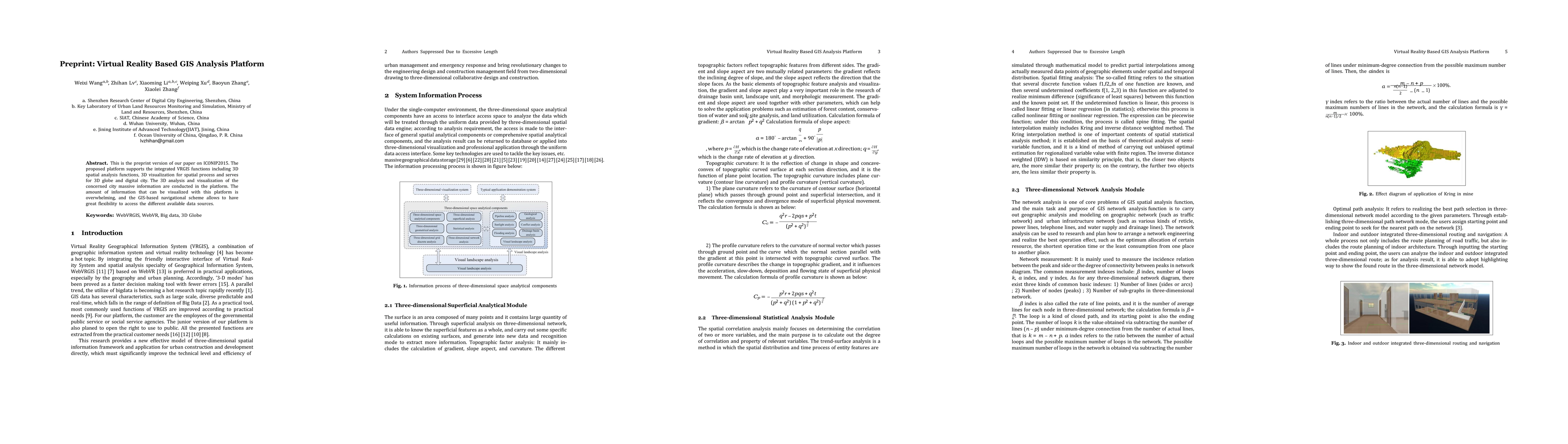
AI Quick Summary
This preprint presents a VRGIS analysis platform that integrates 3D spatial analysis and visualization for 3D globe and digital city applications, offering extensive data visualization and flexible GIS-based navigation.
Paper Preview
Abstract
This is the preprint version of our paper on ICONIP2015. The proposed platform supports the integrated VRGIS functions including 3D spatial analysis functions, 3D visualization for spatial process and serves for 3D globe and digital city. The 3D analysis and visualization of the concerned city massive information are conducted in the platform. The amount of information that can be visualized with this platform is overwhelming, and the GIS based navigational scheme allows to have great flexibility to access the different available data sources.
AI Key Findings
Get AI-generated insights about this paper's methodology, results, significance, and more — seven facets brought into focus.
Impact
Paper Details
PDF Preview
Key Terms
Citation Network
Current paper (gray), citations (green), references (blue)
Display is limited for performance on very large graphs.
Discussion 0