Prototyping Information Visualization in 3D City Models: a Model-based Approach
Publication
Metrics
AI Quick Summary
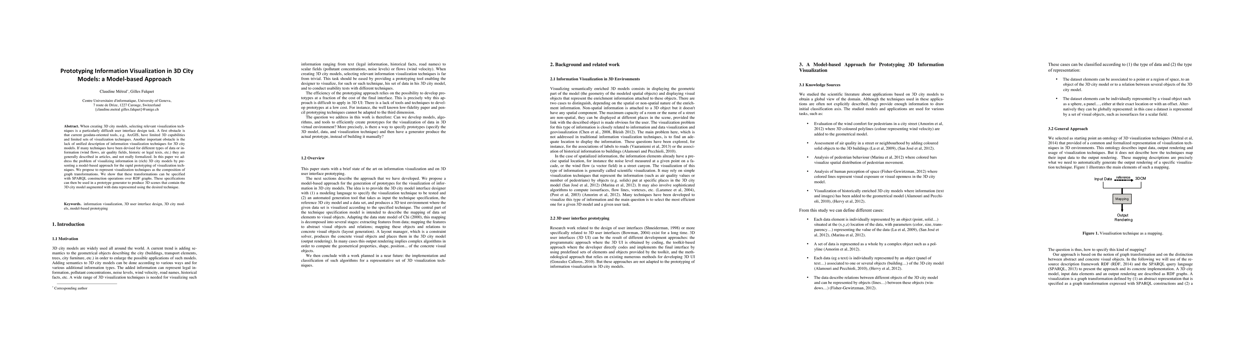
This paper proposes a model-based approach for rapidly prototyping information visualization techniques in 3D city models, addressing the limitations of current geodata tools and the lack of formalized visualization methods. The approach uses graph transformations specified with SPARQL over RDF graphs to generate 3D scenes that augment city models with data visualizations.
Paper Preview
Abstract
When creating 3D city models, selecting relevant visualization techniques is a particularly difficult user interface design task. A first obstacle is that current geodata-oriented tools, e.g. ArcGIS, have limited 3D capabilities and limited sets of visualization techniques. Another important obstacle is the lack of unified description of information visualization techniques for 3D city models. If many techniques have been devised for different types of data or information (wind flows, air quality fields, historic or legal texts, etc.) they are generally described in articles, and not really formalized. In this paper we address the problem of visualizing information in (rich) 3D city models by presenting a model-based approach for the rapid prototyping of visualization techniques. We propose to represent visualization techniques as the composition of graph transformations. We show that these transformations can be specified with SPARQL construction operations over RDF graphs. These specifications can then be used in a prototype generator to produce 3D scenes that contain the 3D city model augmented with data represented using the desired technique.
AI Key Findings
Get AI-generated insights about this paper's methodology, results, significance, and more — seven facets brought into focus.
Impact
Paper Details
PDF Preview
Key Terms
Citation Network
Current paper (gray), citations (green), references (blue)
Display is limited for performance on very large graphs.
Discussion 0