Summary
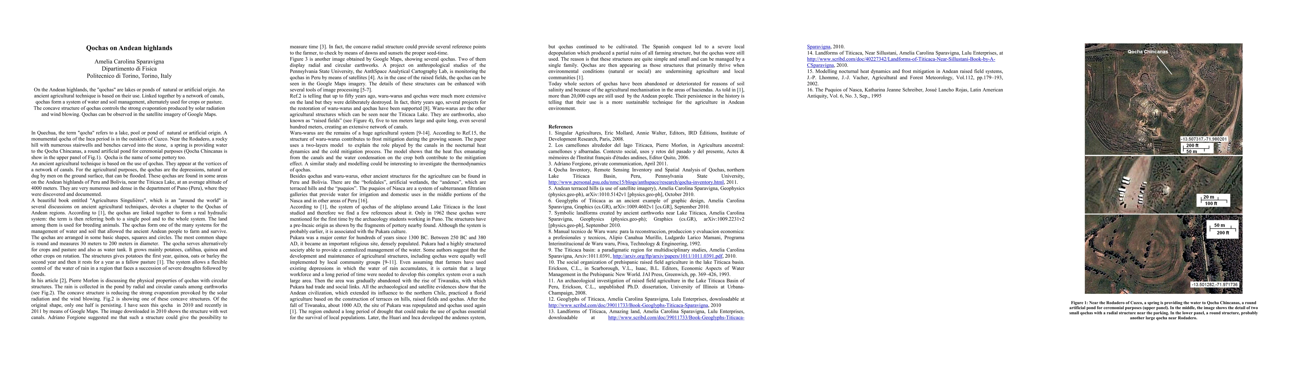
On the Andean highlands, the "qochas" are lakes or ponds of natural or artificial origin. An ancient agricultural technique is based on their use. Linked together by a network of canals, qochas form a system of water and soil management, alternately used for crops or pasture. The concave structure of qochas controls the strong evaporation produced by solar radiation and wind blowing. Qochas can be observed in the satellite imagery of Google Maps.
AI Key Findings
Get AI-generated insights about this paper's methodology, results, and significance.
Paper Details
PDF Preview
Key Terms
linked
(0.285)
controls
(0.281)
satellite
(0.270)
management
(0.267)
water
(0.266)
wind
(0.257)
artificial
(0.242)
origin
(0.227)
Citation Network
Current paper (gray), citations (green), references (blue)
Display is limited for performance on very large graphs.
Current Paper
Citations
References
Click to view
Similar Papers
Found 4 papers| Title | Authors | Year | Actions |
|---|
Comments (0)