Quantifying and extending the coverage of spatial categorization data sets
Publication
Metrics
Paper Preview
Abstract
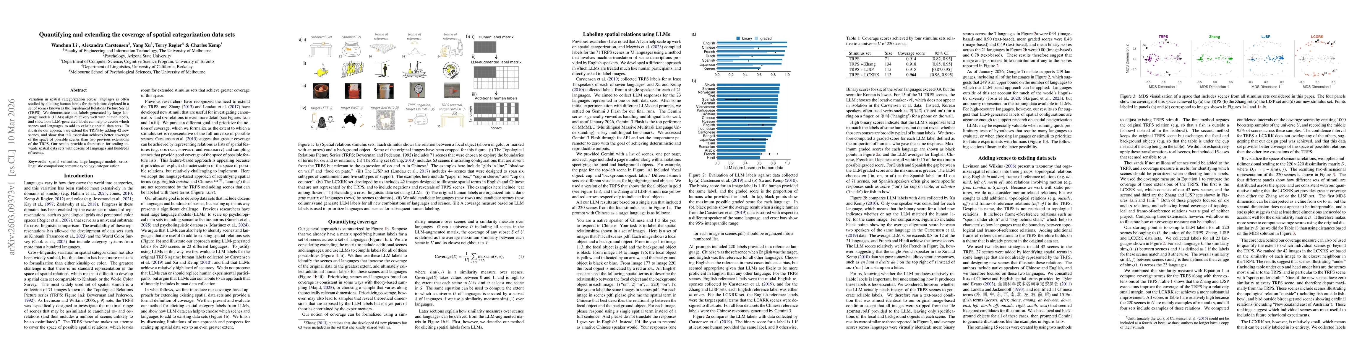
Variation in spatial categorization across languages is often studied by eliciting human labels for the relations depicted in a set of scenes known as the Topological Relations Picture Series (TRPS). We demonstrate that labels generated by large language models (LLMs) align relatively well with human labels, and show how LLM-generated labels can help to decide which scenes and languages to add to existing spatial data sets. To illustrate our approach we extend the TRPS by adding 42 new scenes, and show that this extension achieves better coverage of the space of possible scenes than two previous extensions of the TRPS. Our results provide a foundation for scaling towards spatial data sets with dozens of languages and hundreds of scenes.
AI Key Findings
Get AI-generated insights about this paper's methodology, results, significance, and more — seven facets brought into focus.
Discussion 0