Publication
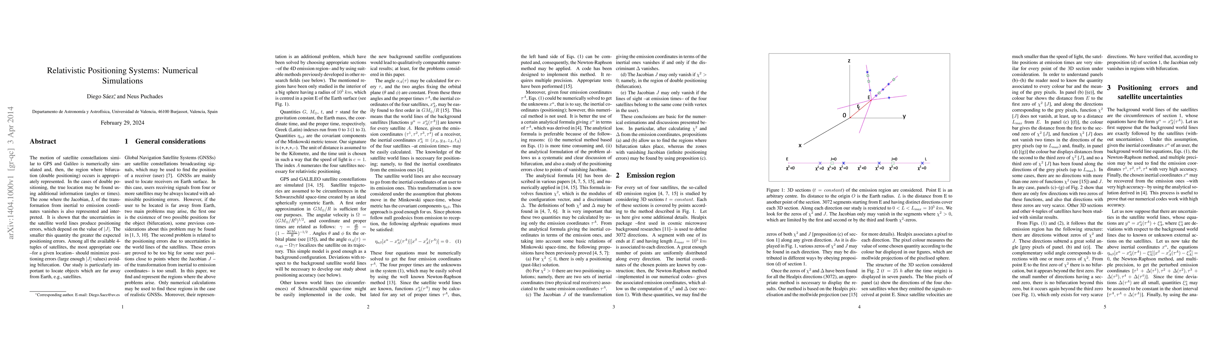
Metrics
AI Quick Summary
This paper numerically simulates satellite constellations like GPS and Galileo to identify regions where bifurcation (double positioning) occurs. It emphasizes the importance of additional information to resolve true locations and analyzes the Jacobian, J, to determine positioning errors, highlighting the need for large |J| values to minimize errors.
Paper Preview
Abstract
The motion of satellite constellations similar to GPS and Galileo is numerically simulated and, then, the region where bifurcation (double positioning) occurs is appropriately represented. In the cases of double positioning, the true location may be found using additional information (angles or times). The zone where the Jacobian, J, of the transformation from inertial to emission coordinates vanishes is also represented and interpreted. It is shown that the uncertainties in the satellite world lines produce positioning errors, which depend on the value of |J|. The smaller this quantity the greater the expected positioning errors. Among all the available 4-tuples of satellites, the most appropriate one -for a given location- should minimize positioning errors (large enough |J| values) avoiding bifurcation. Our study is particularly important to locate objects which are far away from Earth, e.g., satellites.
AI Key Findings
Get AI-generated insights about this paper's methodology, results, significance, and more — seven facets brought into focus.
Impact
Paper Details
PDF Preview
Key Terms
Citation Network
Current paper (gray), citations (green), references (blue)
Display is limited for performance on very large graphs.
Discussion 0