Publication
Metrics
AI Quick Summary
This paper proposes a new CNN framework for semi-automatic detection of relict landslides in rainforest areas using deep learning for image segmentation. The framework shows improved detection accuracy compared to standard methods, though precision remains low due to false positives, highlighting the challenges in differentiating landslide scars from similar vegetation.
Paper Preview
Abstract
Landslides are destructive and recurrent natural disasters on steep slopes and represent a risk to lives and properties. Knowledge of relict landslides location is vital to understand their mechanisms, update inventory maps and improve risk assessment. However, relict landslide mapping is complex in tropical regions covered with rainforest vegetation. A new CNN framework is proposed for semi-automatic detection of relict landslides, which uses a dataset generated by a k-means clustering algorithm and has a pre-training step. The weights computed in the pre-training are used to fine-tune the CNN training process. A comparison between the proposed and the standard framework is performed using CBERS-04A WPM images. Three CNNs for semantic segmentation are used (Unet, FPN, Linknet) with two augmented datasets. A total of 42 combinations of CNNs are tested. Values of precision and recall were very similar between the combinations tested. Recall was higher than 75% for every combination, but precision values were usually smaller than 20%. False positives (FP) samples were addressed as the cause for these low precision values. Predictions of the proposed framework were more accurate and correctly detected more landslides. This work demonstrates that there are limitations for detecting relict landslides in areas covered with rainforest, mainly related to similarities between the spectral response of pastures and deforested areas with Gleichenella sp. ferns, commonly used as an indicator of landslide scars.
AI Key Findings
Get AI-generated insights about this paper's methodology, results, significance, and more — seven facets brought into focus.
Impact
Paper Details
Authors
PDF Preview
Key Terms
Citation Network
Current paper (gray), citations (green), references (blue)
Display is limited for performance on very large graphs.
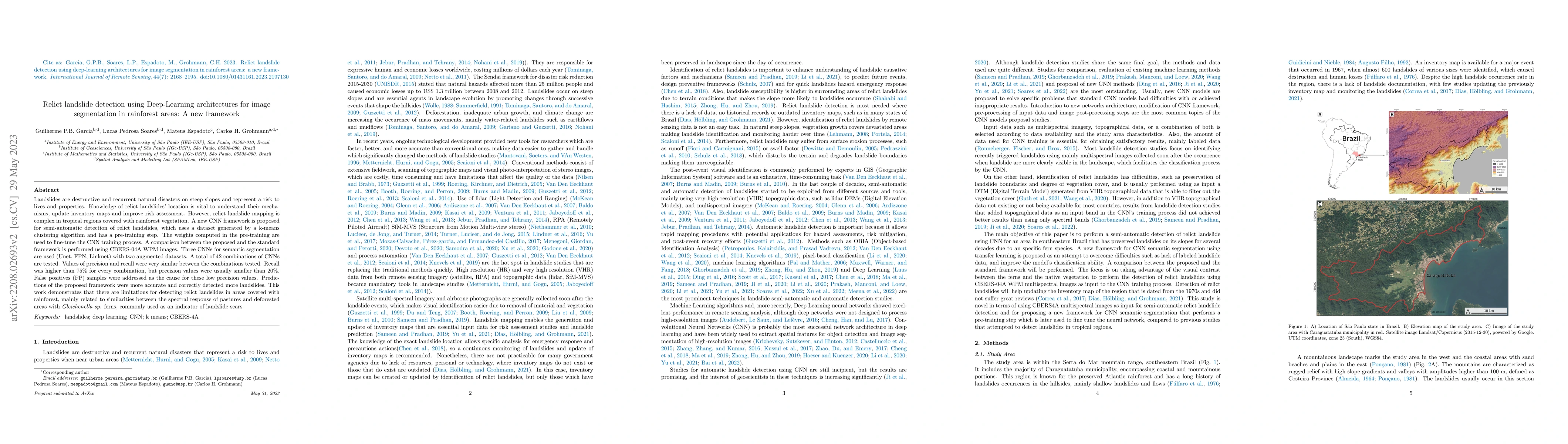
Discussion 0