Remote Sensing for Weed Detection and Control
Publication
Metrics
AI Quick Summary
This paper explores the use of remote sensing via drone and satellite imagery for detecting and controlling Italian ryegrass in winter wheat fields, employing over 600 neural network architectures to optimize precision spraying. The best model achieves 99% accuracy in weed segmentation, significantly reducing herbicide use and costs.
Paper Preview
Abstract
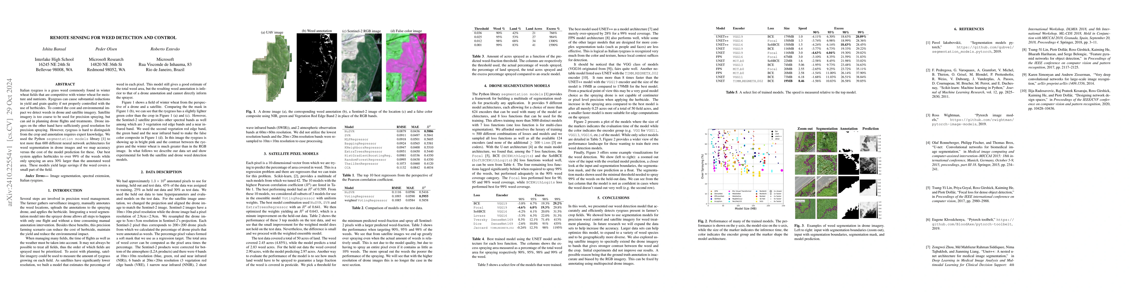
Italian ryegrass is a grass weed commonly found in winter wheat fields that are competitive with winter wheat for moisture and nutrients. Ryegrass can cause substantial reductions in yield and grain quality if not properly controlled with the use of herbicides. To control the cost and environmental impact we detect weeds in drone and satellite imagery. Satellite imagery is too coarse to be used for precision spraying, but can aid in planning drone flights and treatments. Drone images on the other hand have sufficiently good resolution for precision spraying. However, ryegrass is hard to distinguish from the crop and annotation requires expert knowledge. We used the Python segmentation models library to test more than 600 different neural network architectures for weed segmentation in drone images and we map accuracy versus the cost of the model prediction for these. Our best system applies herbicides to over 99% of the weeds while only spraying an area 30% larger than the annotated weed area. These models yield large savings if the weed covers a small part of the field.
AI Key Findings
Get AI-generated insights about this paper's methodology, results, significance, and more — seven facets brought into focus.
Impact
Paper Details
Authors
PDF Preview
Citation Network
Current paper (gray), citations (green), references (blue)
Display is limited for performance on very large graphs.
Discussion 0