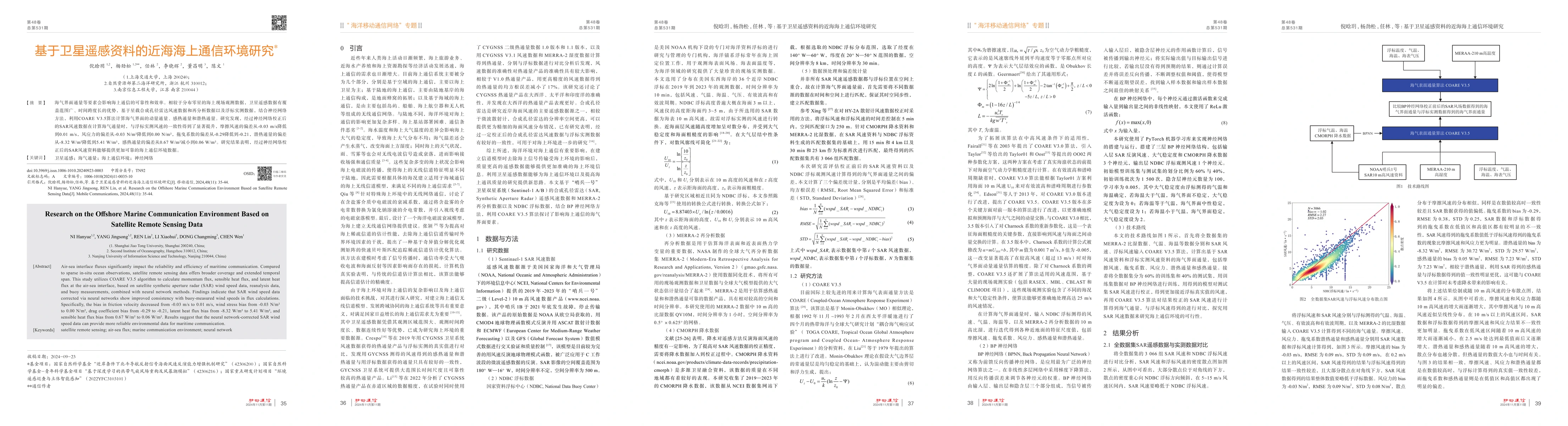
Air-sea interface fluxes significantly impact the reliability and efficiency
of maritime communication. Compared to sparse in-situ ocean observations,
satellite remote sensing data offers broader coverage and extended temporal
span. This study utilizes COARE V3.5 algorithm to calculate momentum flux,
sensible heat flux, and latent heat flux at the air-sea interface, based on
satellite synthetic aperture radar (SAR) wind speed data, reanalysis data, and
buoy measurements, combined with neural network methods. Findings indicate that
SAR wind speed data corrected via neural networks show improved consistency
with buoy-measured wind speeds in flux calculations. Specifically, the bias in
friction velocity decreased from -0.03 m/s to 0.01 m/s, wind stress bias from
-0.03 N/m^2 to 0.00 N/m^2, drag coefficient bias from -0.29 to -0.21, latent
heat flux bias from -8.32 W/m^2 to 5.41 W/m^2, and sensible heat flux bias from
0.67 W/m^2 to 0.06 W/m^2. Results suggest that the neural network-corrected SAR
wind speed data can provide more reliable environmental data for maritime
communication.
Discussion 0