Summary
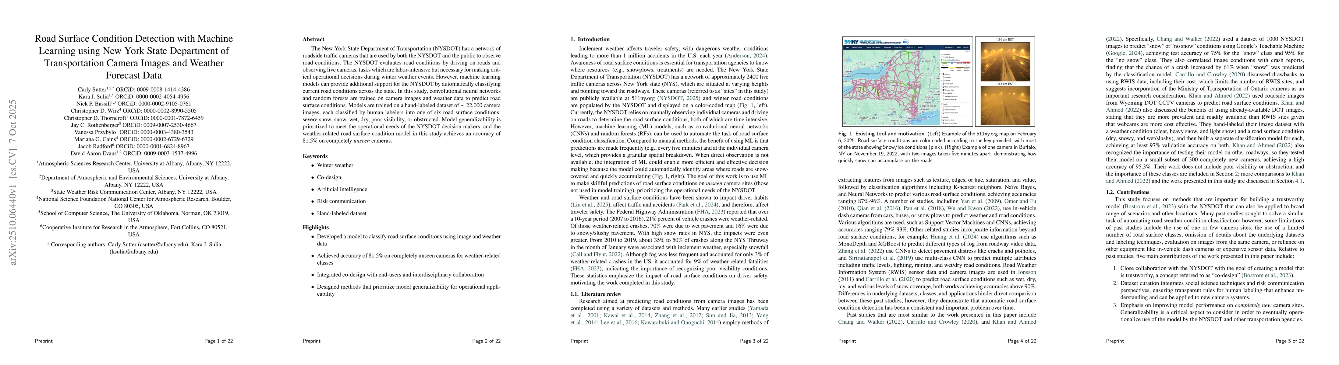
The New York State Department of Transportation (NYSDOT) has a network of roadside traffic cameras that are used by both the NYSDOT and the public to observe road conditions. The NYSDOT evaluates road conditions by driving on roads and observing live cameras, tasks which are labor-intensive but necessary for making critical operational decisions during winter weather events. However, machine learning models can provide additional support for the NYSDOT by automatically classifying current road conditions across the state. In this study, convolutional neural networks and random forests are trained on camera images and weather data to predict road surface conditions. Models are trained on a hand-labeled dataset of ~22,000 camera images, each classified by human labelers into one of six road surface conditions: severe snow, snow, wet, dry, poor visibility, or obstructed. Model generalizability is prioritized to meet the operational needs of the NYSDOT decision makers, and the weather-related road surface condition model in this study achieves an accuracy of 81.5% on completely unseen cameras.
AI Key Findings
Generated Oct 10, 2025
Methodology
The study employed a combination of deep learning models and traditional machine learning techniques to analyze road surface conditions using camera images and weather data. A quantitative content analysis approach was used to manually label the dataset, and various models such as CNNs, Random Forests, and Gradient Boosting were trained and evaluated for their performance in classifying road conditions.
Key Results
- The deep learning models achieved higher accuracy in classifying road surface conditions compared to traditional machine learning methods.
- The integration of weather data with camera images significantly improved the model's ability to detect hazardous road conditions.
- The quantitative content analysis provided a reliable and consistent labeling framework for the dataset.
Significance
This research contributes to improving road safety by enabling more accurate detection of hazardous road conditions, which can support better traffic management and driver awareness systems. The methodology can be applied to other regions with similar infrastructure and weather challenges.
Technical Contribution
The technical contribution includes the development of an efficient deep learning framework for road condition classification and the creation of a standardized dataset with quantitative content analysis labels, which can serve as a benchmark for future research.
Novelty
This work introduces a novel combination of deep learning and quantitative content analysis for road surface condition classification, which addresses the limitations of previous approaches by improving both accuracy and data consistency.
Limitations
- The study relied on a specific dataset from New York State, which may limit the generalizability of the results to other regions.
- The manual labeling process for the dataset is time-consuming and could introduce human bias.
Future Work
- Expanding the dataset to include more diverse geographic and weather conditions.
- Investigating the use of real-time data streaming for continuous monitoring of road conditions.
- Exploring the integration of additional sensor data such as LiDAR or radar for improved accuracy.
Comments (0)