RoofDiffusion: Constructing Roofs from Severely Corrupted Point Data via Diffusion
Publication
Metrics
AI Quick Summary
RoofDiffusion is a self-supervised diffusion technique that robustly completes and denoises roof height maps from severely corrupted point data, leveraging curated footprints to handle up to 99% sparsity and 80% occlusion. It outperforms existing methods in reconstruction tasks, enhancing 3D building models and introducing a new dataset for remote sensing challenges.
Paper Preview
Abstract
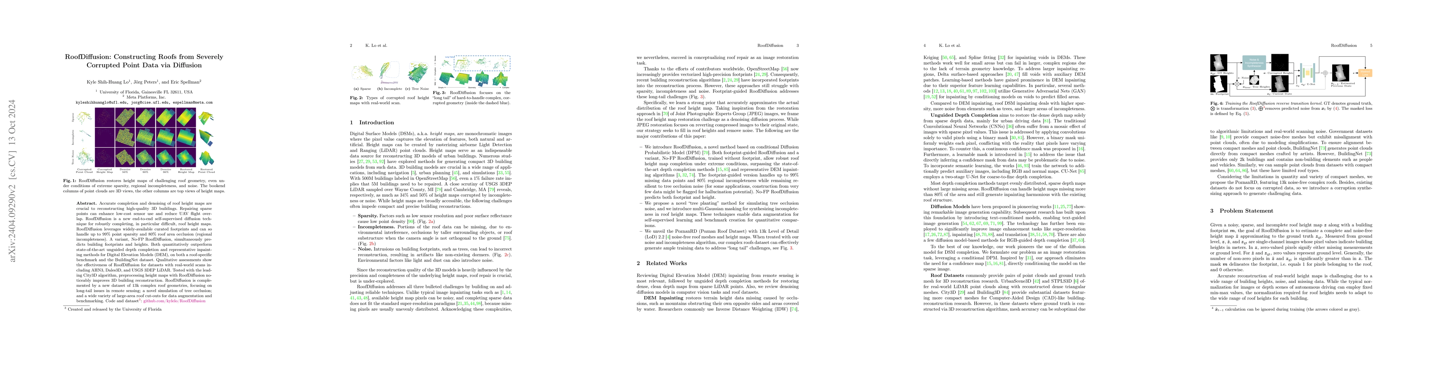
Accurate completion and denoising of roof height maps are crucial to reconstructing high-quality 3D buildings. Repairing sparse points can enhance low-cost sensor use and reduce UAV flight overlap. RoofDiffusion is a new end-to-end self-supervised diffusion technique for robustly completing, in particular difficult, roof height maps. RoofDiffusion leverages widely-available curated footprints and can so handle up to 99\% point sparsity and 80\% roof area occlusion (regional incompleteness). A variant, No-FP RoofDiffusion, simultaneously predicts building footprints and heights. Both quantitatively outperform state-of-the-art unguided depth completion and representative inpainting methods for Digital Elevation Models (DEM), on both a roof-specific benchmark and the BuildingNet dataset. Qualitative assessments show the effectiveness of RoofDiffusion for datasets with real-world scans including AHN3, Dales3D, and USGS 3DEP LiDAR. Tested with the leading City3D algorithm, preprocessing height maps with RoofDiffusion noticeably improves 3D building reconstruction. RoofDiffusion is complemented by a new dataset of 13k complex roof geometries, focusing on long-tail issues in remote sensing; a novel simulation of tree occlusion; and a wide variety of large-area roof cut-outs for data augmentation and benchmarking.
AI Key Findings
Get AI-generated insights about this paper's methodology, results, significance, and more — seven facets brought into focus.
Impact
Paper Details
Authors
PDF Preview
Key Terms
Citation Network
Current paper (gray), citations (green), references (blue)
Display is limited for performance on very large graphs.
Discussion 0