Route Packing: Geospatially-Accurate Visualization of Route Networks
Publication
Metrics
AI Quick Summary
Researchers developed Route Packing, a visualization technique that displays multiple routes on a map while preserving layout and directionality, improving route tracing performance with key visual parameters identified.
Paper Preview
Abstract
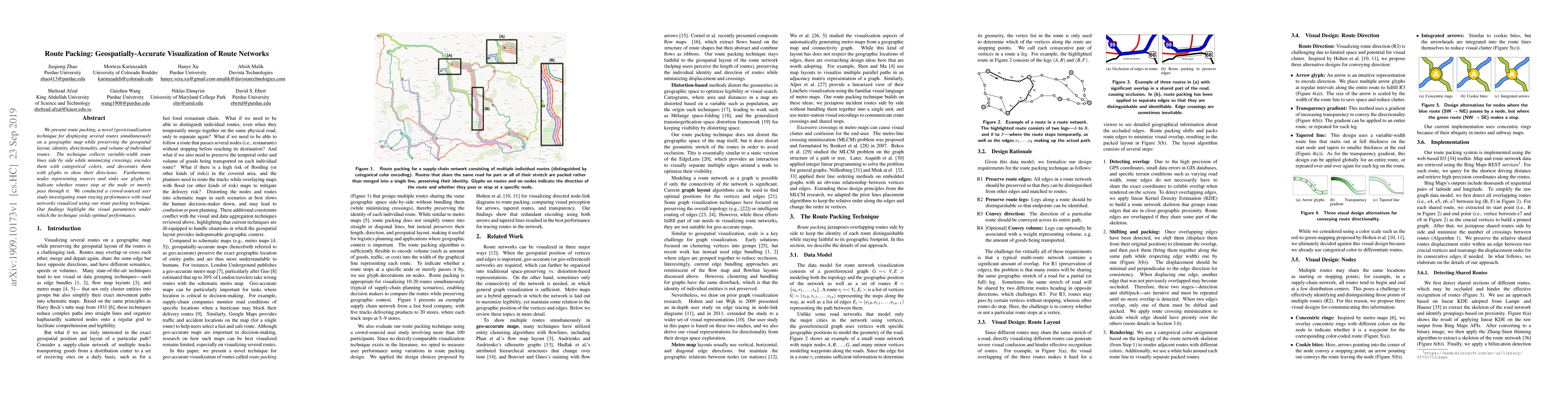
We present route packing, a novel (geo)visualization technique for displaying several routes simultaneously on a geographic map while preserving the geospatial layout, identity, directionality, and volume of individual routes. The technique collects variable-width route lines side by side while minimizing crossings, encodes them with categorical colors, and decorates them with glyphs to show their directions. Furthermore, nodes representing sources and sinks use glyphs to indicate whether routes stop at the node or merely pass through it. We conducted a crowd-sourced user study investigating route tracing performance with road networks visualized using our route packing technique. Our findings highlight the visual parameters under which the technique yields optimal performance.
AI Key Findings
Get AI-generated insights about this paper's methodology, results, significance, and more — seven facets brought into focus.
Impact
Paper Details
Authors
PDF Preview
Key Terms
Citation Network
Current paper (gray), citations (green), references (blue)
Display is limited for performance on very large graphs.
Discussion 0