01
MethodologyHow they did it
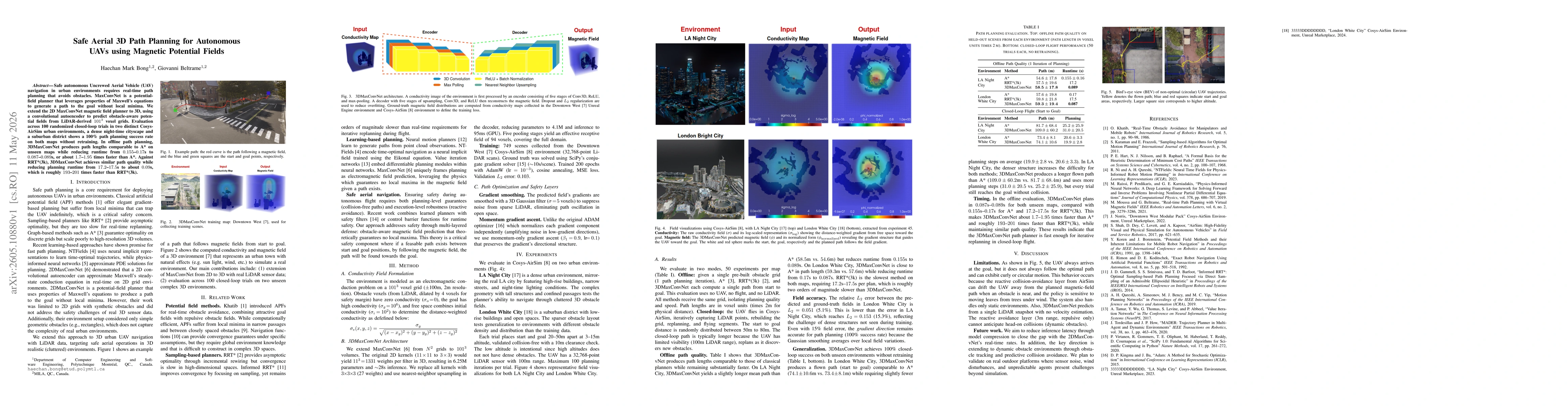
The study extends 2D MaxConvNet to 3D by using a convolutional autoencoder to predict obstacle-aware magnetic fields from LiDAR-derived 1013 voxel grids; conductivity-based field formulation (σe) is used to generate a 3D magnetic field guiding path planning; a 3D encoder-decoder network with 3x3x3 kernels and 5 pooling/upsampling stages produces field predictions; post-processing includes gradient smoothing with a 3D Gaussian and momentum gradient ascent for path optimization; offline evaluation on held-out 3D urban scenes and online closed-loop trials in Cosys-AirSim environments validate performance without retraining.
Discussion 0