Cross-modal artificial intelligence has garnered widespread attention in
recent years, achieving significant progress in the study of natural images.
However, existing methods are mostly designed for RGB imagery, leaving a
significant gap in modeling synthetic aperture radar (SAR) imagery. SAR, with
its all-day, all-weather imaging capabilities, plays an irreplaceable role in
remote sensing scene understanding. To address this gap, this paper proposes
SAR-KnowLIP, the first universal SAR multimodal foundational model, along with
reusable data and evaluation baselines. Specifically: (1) This work introduces
the critical yet long-overlooked attribute of geographic information into
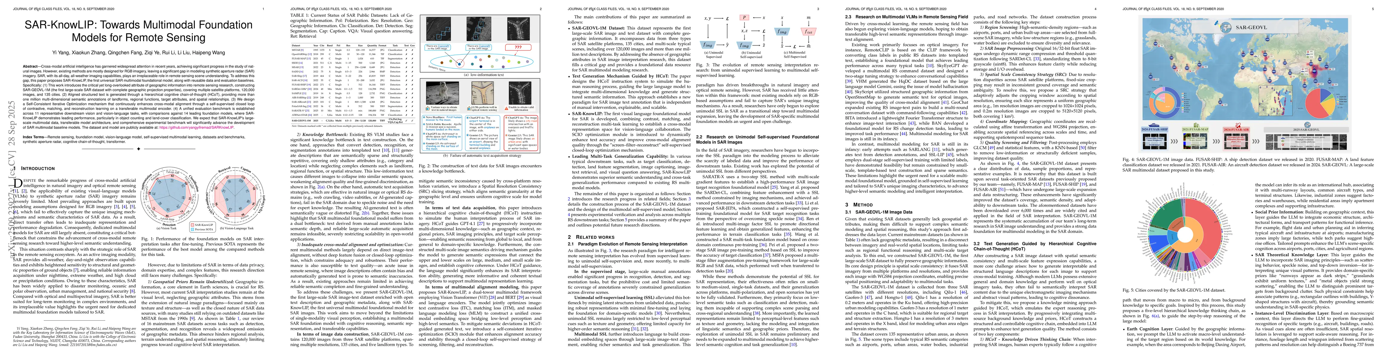
remote sensing research, constructing SAR-GEOVL-1M (the first large-scale SAR
dataset with complete geographic projection properties), covering multiple
satellite platforms, 120,000 images, and 135 cities. (2) Aligned structured
text is generated through a hierarchical cognitive chain-of-thought (HCoT),
providing more than one million multi-dimensional semantic annotations of
landforms, regional functions, target attributes, and spatial relationships.
(3) We design a Self-Consistent Iterative Optimization mechanism that
continuously enhances cross-modal alignment through a self-supervised closed
loop of contrastive, matching, and reconstruction learning on a transferable
multimodal encoder. (4) A unified evaluation benchmark is established across 11
representative downstream vision and vision-language tasks, with comparisons
against 14 leading foundation models, where SAR-KnowLIP demonstrates leading
performance, particularly in object counting and land-cover classification. We
expect that SAR-KnowLIP's large-scale multimodal data, transferable model
architecture, and comprehensive experimental benchmark will significantly
advance the development of SAR multimodal baseline models.
Discussion 0