Publication
Metrics
AI Quick Summary
A study comparing two entropy measures for satellite image classification and segmentation found that Tsallis entropy outperforms standard entropy in classifying aquatic, urban, and vegetation regions.
Paper Preview
Abstract
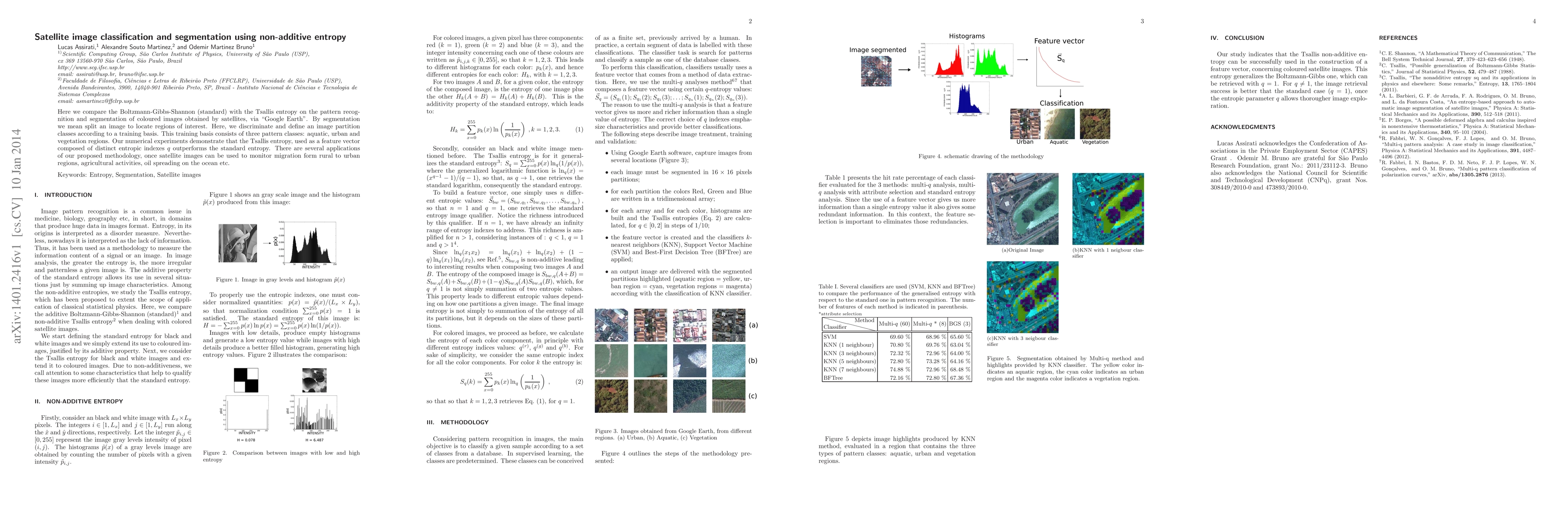
Here we compare the Boltzmann-Gibbs-Shannon (standard) with the Tsallis entropy on the pattern recognition and segmentation of coloured images obtained by satellites, via "Google Earth". By segmentation we mean split an image to locate regions of interest. Here, we discriminate and define an image partition classes according to a training basis. This training basis consists of three pattern classes: aquatic, urban and vegetation regions. Our numerical experiments demonstrate that the Tsallis entropy, used as a feature vector composed of distinct entropic indexes $q$ outperforms the standard entropy. There are several applications of our proposed methodology, once satellite images can be used to monitor migration form rural to urban regions, agricultural activities, oil spreading on the ocean etc.
AI Key Findings
Get AI-generated insights about this paper's methodology, results, significance, and more — seven facets brought into focus.
Impact
Paper Details
PDF Preview
Key Terms
Citation Network
Current paper (gray), citations (green), references (blue)
Display is limited for performance on very large graphs.
Discussion 0