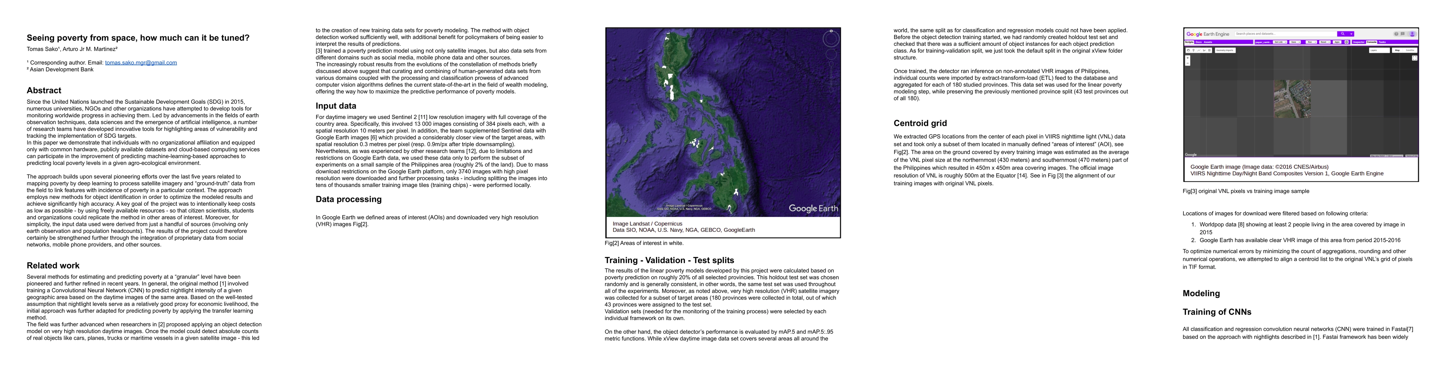
Seeing poverty from space, how much can it be tuned?
Publication
Metrics
AI Quick Summary
This paper shows how individuals with basic resources can contribute to predicting poverty levels using satellite imagery and machine learning, achieving high accuracy with low costs. It emphasizes the potential for citizen scientists and students to replicate this method, suggesting further improvements with additional data sources.
Paper Preview
Abstract
Since the United Nations launched the Sustainable Development Goals (SDG) in 2015, numerous universities, NGOs and other organizations have attempted to develop tools for monitoring worldwide progress in achieving them. Led by advancements in the fields of earth observation techniques, data sciences and the emergence of artificial intelligence, a number of research teams have developed innovative tools for highlighting areas of vulnerability and tracking the implementation of SDG targets. In this paper we demonstrate that individuals with no organizational affiliation and equipped only with common hardware, publicly available datasets and cloud-based computing services can participate in the improvement of predicting machine-learning-based approaches to predicting local poverty levels in a given agro-ecological environment. The approach builds upon several pioneering efforts over the last five years related to mapping poverty by deep learning to process satellite imagery and "ground-truth" data from the field to link features with incidence of poverty in a particular context. The approach employs new methods for object identification in order to optimize the modeled results and achieve significantly high accuracy. A key goal of the project was to intentionally keep costs as low as possible - by using freely available resources - so that citizen scientists, students and organizations could replicate the method in other areas of interest. Moreover, for simplicity, the input data used were derived from just a handful of sources (involving only earth observation and population headcounts). The results of the project could therefore certainly be strengthened further through the integration of proprietary data from social networks, mobile phone providers, and other sources.
AI Key Findings
Get AI-generated insights about this paper's methodology, results, significance, and more — seven facets brought into focus.
Impact
Paper Details
Authors
PDF Preview
Key Terms
Citation Network
Current paper (gray), citations (green), references (blue)
Display is limited for performance on very large graphs.
Discussion 0